Italiano
 Deutsch
Pietra Grande sentiero Vidi

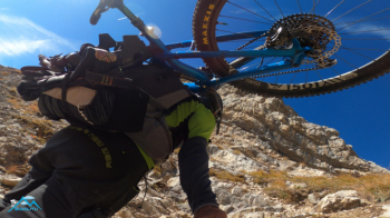
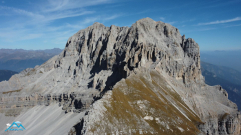
This is one of those trips that even if you don't repeat for sure you won't forget. Essential some basic mountaineering knowledge, absence of vertigo and mastery of the medium even when the objective difficulty that is not high but the route is housed in a context that exacerbates any aspect of serenity or anxiety. Useful, to be used as needed the harness and straps to be inserted in the braking system when disassembling the wheels.
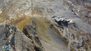
We start from the Grostè Express parking lot between Madonna di Campiglio and the Carlo Magno Pass and take the road to the Graffer and Stoppani refuges, after a few challenging ramps 800 meters of elevation gain and about 2 hours we are at the Stoppani Refuge at Grostè. Other times this is the end of the climb and we prepare for the well-deserved descent but this time it is only an intermediate stage, the smoothest.
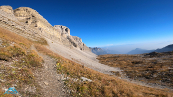
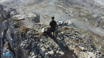
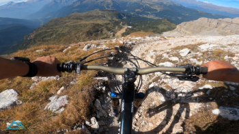
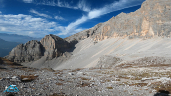
At the highest point where we descend the Val di Flavona bending sharply to the left climbs scurvy the attack on the Christmas Vidi EQUIPPED trail, the beginning of our adventure, the juicy part of the trip. I could end the description of the route here because from this point on, you cannot and should not turn away from the trail. The route is challenging because of the weight but above all the encumbrance of the bike on the shoulder, in one specific passage the bike must be shifted separate from the wheels, those later.
Thus 250 meters of elevation gain of sublime scenic beauty are covered, which mixed with the adrenaline that mounts in certain passages make this climb of enormous satisfaction.
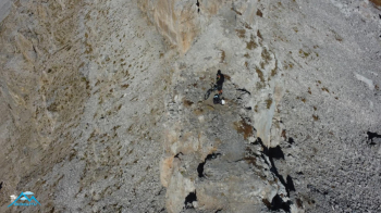
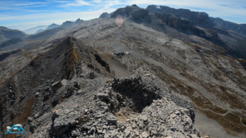
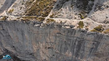
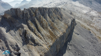
At 2640 meters the turning point, now begins a false-flat ledge 50cm wide easy easy when I walked it but on the bike things change and not a little for me. I have never lavished so much attention on a path so easy but that at the edge presents you with the abyss. Then the spectacular ledge ends, we climb up three convenient ladders and descend one then again down a narrow chimney and the bike on the shoulders fortunately stays outside.
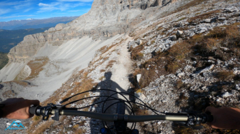
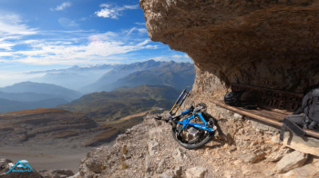
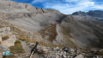
We arrive at the legendary bench dedicated to the mountain guide Natale Vidi, which in that setting is more comfortable and cozy than a 5-star hotel, positioned sheltered under a red Dolomite roof, ecstasy again. One more scurrilous unprotected traverse then we put the wheels back on and start cycling again on comfortable easy trail to the confluence of the trail coming from the Vagliana/Orti della Regina and down again until we get around the rocky outcrop that is easy to cycle except for short sections where I have to accompany the bike.
We now pass the Graffer Refuge aqueduct which with amusing traverse brings us back to civilization. Before reaching the Graffer we bend sharply to the right toward malga Vagliana and Vaglianella and with the undulating trail we face the traverse to Dos del Sparavèr at 2140 meters. Now the descent is true to the two malgas. After Malga Vaglianella we follow the dirt road for 150 meters and to the right under the road a very fun trail to go all the way back to Passo Carlo Magno and the car.
What can I say, this is not to be considered just as a bike ride, there is much more to it, a pure cyclist surely does not look for this and I strongly urge him not to consider this trip.
I enjoyed it so much, I planned it long ago and walked the route first to feel its feasibility with bike in tow, I am glad I did it, I also took from it that for my abilities and strengths the bar that indicates the limit can only be lowered.