Italiano
 Deutsch
Tutte le Dolomiti di Brenta in un giorno

Itinerary conceived by Pietro Novelli (grandpabanshee) and designed for two days, I slightly modified it and my challenge was to do it in one day. I'll say the most important thing right away: out of 4000 meters of elevation gain, you have to carry your bike on your back for at least 1500 meters, because you pass right in the middle of the Brenta Dolomites, so the route is quite extreme.
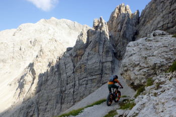
For convenience I start from the lowest point, at the La Fabbrica brewery, 500 meters away. You go up toward Tuenno on an immediately steep road and then toward Lake Tovel, first on the road and then on a beautiful trail. From the lake you pedal to malga Pozzol and then to malga Flavona, first pushing and then pedaling. From here you climb on 371 and 301, some pedaling and much backpacking, to Grostè Pass. You descend on 316 and 331 to the Graffer hut, or by cutting directly across the ski slope.
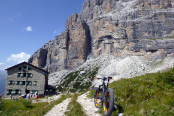
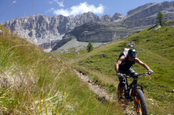
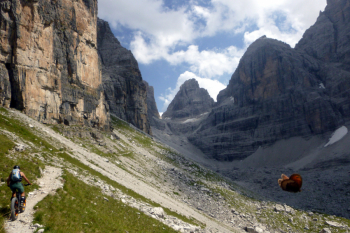
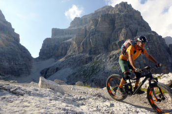
You descend on the beautiful 382 to malga Vallesinella. Take the 317b, partly pedaling and partly pushing, to ref. Casinei. Then on 391, the first part pedaled and exposed, then steep shoulder climb to Brentei hut. Continue on 318, first pedalable then very difficult on poorly marked scree and ferratina, to 2550 Bocca di Brenta. Descend to ref. Pedrotti and from here beautiful and challenging descent on 319 to malga Selvata.
Then again on 319 all in the woods to the forestry. It climbs up a little to the Croz dell'Altissimo refuge. From here beautiful false-floor trail (bike ban, but almost all rideable) to the Pradel refuge. Descend on the Bear trail to Andalo.
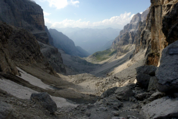
From Andalo almost all on beautiful trail at the edge of the forest, with still lots of up and down, to the finish. To cut some asphalt and elevation gain, you can take the tunnel from Terres to the Tovel valley, open only during the day, however. Very difficult route in one day, I took from 5:30 to 11:30 p.m., but also very challenging in two days. The ascent to Bocca di Brenta is really difficult, on landslide scree, I think I am the first one to have climbed it by bike, but even so it changes little. Best done in summer, when the snow has melted, and on a clear day to take in the fabulous views! Only for experienced downhill bikers with plenty of desire to carry the bike a long way!
Note on the bans: some trails within the Brenta Park are forbidden to bikes, I did the ride on a Saturday in August and passed very few people, outside of Grostè where the gondola unloads thousands of people dressed in city clothes. Just stop, let the few pedestrians you cross, wave and there is no problem. In any case, it will never be a mass route because the Bocca di Brenta trail is already difficult even on foot.