HOME RANKINGS CHALLENGES ROUTES POI PLANNING SEARCH LOGIN
Italy - Valle d'Aosta, AO
2023/08/11 21:44:42

Cima Creya e Tersiva

36 Downloads
2
 
Share
Author
Place
Italy - Valle d'Aosta, AO
Km
52,17 km
Elapsed time
26:25:31
Vertical meters
+3 400 mt (1541 - 3461)
Route difficulty
Landscapes
Last update
2023/08/13 08:58:11
Comments
0
Description

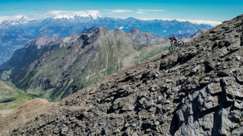
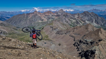
Epic two-day tour that touches the peaks of two very beautiful peaks above Cogne and Valnontey: Mt. Creya and Tersiva. Departing from Cogne, you pedal up to the Colonna Mine, from there on you continue on trail with push or shoulder bikes to the summit of Mt. Creya. From the summit, descend on an initially very technical trail until you reach the vallon de Grauson. Ascend to the Muggia bivouac on a trail that is for many stretches bikeable.

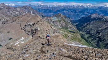
From the bivouac you attack the summit of Tersiva with about 600mt of bike backpacking. The descent from the summit is very vertical and technical, only for experts. It descends again into the vallon de Grauson with long sections of flow trail. Ascent to col Invergneux almost mostly bikeable. Very varied descent to cogne that alternates technical sections, sometimes a bit exposed, long very flow sections to very physical sections...eternal.

Tour recommended for people trained and experienced in high altitude alpine descents.


Download our free mobile app to send this route to your Garmin device or to navigate it on OSM maps. Android - iOS
Local weather
Today
5 °C
Tonight
-2 °C
Tomorrow
4 °C
Tomorrow night
-3 °C
Wednesday
5 °C
Wednesday night
-2 °C
Thursday
6 °C
Thursday night
-6 °C
Friday
4 °C
Friday night
-7 °C

Graph

Nearest Routes

2022/08/07
- Italy - Valle d'Aosta, AO
gmzolenart
(115)
30,79 km
Km
+1 471 mt
Vertical meters
Route difficulty
Landscapes
2022/08/06
- Italy - Valle d'Aosta, AO
gmzolenart
(115)
23,17 km
Km
+1 015 mt
Vertical meters
Route difficulty
Landscapes
2022/09/05
- Italy - Valle d'Aosta, AO
BAROLO71
(34)
33,15 km
Km
+2 277 mt
Vertical meters
Route difficulty
Landscapes
2023/08/05
- Italy - Valle d'Aosta, AO
37,61 km
Km
+800 mt
Vertical meters
Route difficulty
Landscapes
2022/08/22
- Italy - Valle d'Aosta, AO
nonnocarb
(292)
17,77 km
Km
+1 079 mt
Vertical meters
Route difficulty
Landscapes
2022/09/04
- Italy - Valle d'Aosta, AO
gmzolenart
(115)
29,77 km
Km
+1 356 mt
Vertical meters
Route difficulty
Landscapes
2023/09/12
- Italy - Valle d'Aosta, AO
ebsat
(108)
31,30 km
Km
+2 574 mt
Vertical meters
Route difficulty
Landscapes
2022/08/07
- Italy - Valle d'Aosta, AO
gmzolenart
(115)
25,70 km
Km
+1 475 mt
Vertical meters
Route difficulty
Landscapes
2024/06/27
- Italy - Valle d'Aosta, AO
marco
(129)
37,94 km
Km
+2 399 mt
Vertical meters
Route difficulty
Landscapes
2024/11/06
- Italy - Valle d'Aosta, AO
Paoloc1
(61)
39,20 km
Km
+2 160 mt
Vertical meters
Route difficulty
Landscapes

0 Comments