HOME RANKINGS CHALLENGES ROUTES POI PLANNING SEARCH LOGIN
Italy - Valle d'Aosta, AO
2022/08/07 20:41:37

Colle dell'Entrelor 3.007 m.

8 Downloads
0
 
Author
gmzolenart
(104)
Place
Italy - Valle d'Aosta, AO
Km
25,70 km
Elapsed time
07:01:53
Vertical meters
+1 475 mt (1541 - 3005)
Route difficulty
Landscapes
Last update
2023/01/03 17:00:42
Comments
2
Description

You leave the car in Degioz, a hamlet of Valsavarenche 1545 m, pass by the 'building housing the municipal house and the Gran Paradiso Park tourist information office.

Cross the bridge and keep to the left going uphill; after about 100m, there are the classic yellow footpath signs on the right : follow path 8. It starts with a steep ramp, but then becomes a wide mule track with wide switchbacks that leads in 7km first to the hunting lodge of Orvieille 2,165m and then to Alp Sopranaz 2,283m

From here there is enough pedaling, but not always, due to a hollowed-out path and a narrow, slippery section, to Lake Djouan.

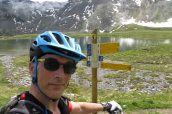
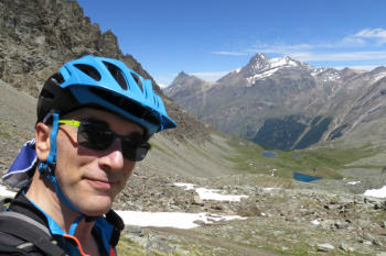
From the lake, continue with fairly high cyclability, first touching Lac Noir 2671 m and then up to the Entrelor Pass following the well-marked trail.

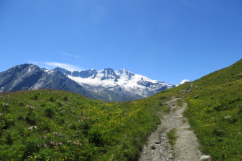
For the descent, which is totally cyclable, from the little house of Orvieilles instead of returning from the royal road traveled uphill, continue on the AV2 to Eaux Rousses on a path for a first part rocky and then flowing in the forest.

Wonderful views and environment on Grampa and Ciarforon in the middle of the Gran Paradiso Park.

Trail map ICG 102 - Valsavarenche, Val di Rhemes, Valgrisenche


Download our free mobile app to send this route to your Garmin device or to navigate it on OSM maps. Android - iOS

Graph

Nearest Routes

31,72 km
Km
+2 440 mt
Vertical meters
Route difficulty
Landscapes
2022/10/03
- Italy - Valle d'Aosta, AO
gmzolenart
(104)
18,80 km
Km
+1 062 mt
Vertical meters
Route difficulty
Landscapes
2022/10/04
- Italy - Valle d'Aosta, AO
gmzolenart
(104)
23,03 km
Km
+1 249 mt
Vertical meters
Route difficulty
Landscapes
2022/08/06
- Italy - Valle d'Aosta, AO
gmzolenart
(104)
23,17 km
Km
+1 015 mt
Vertical meters
Route difficulty
Landscapes
2023/07/31
- Italy - Valle d'Aosta, AO
Staff
(14)
19,82 km
Km
+1 030 mt
Vertical meters
Route difficulty
Landscapes
2023/06/10
- Italy - Valle d'Aosta, AO
marco
(102)
7,95 km
Km
+141 mt
Vertical meters
Route difficulty
Landscapes
2023/08/11
- Italy - Valle d'Aosta, AO
52,17 km
Km
+3 400 mt
Vertical meters
Route difficulty
Landscapes
2022/09/30
- Italy - Valle d'Aosta, AO
gmzolenart
(104)
28,02 km
Km
+1 315 mt
Vertical meters
Route difficulty
Landscapes
2022/08/22
- Italy - Valle d'Aosta, AO
nonnocarb
(266)
14,66 km
Km
+693 mt
Vertical meters
Route difficulty
Landscapes
2022/09/18
- Italy - Valle d'Aosta, AO
yura
(7)
33,33 km
Km
+1 880 mt
Vertical meters
Route difficulty
Landscapes

2 Comments