Italiano
 Deutsch
Alpe di Viou - sentiero 105

At Senin (777 m) Exit the parking lot, opposite is the church, turn left and begin to climb along the paved road until it ends near a picnic area where the dirt road (signs Blavy, Parleaz) begins on the right. Go up into the woods, pass a steep asphalt slope, veer flat to the left thus joining the Ru di Pompillard road. This is an ancient irrigation canal dating from before the 15th century that carries water from the Buthier stream in the commune of Valpelline (940 m) to the castle of Quart (840 m) with an average gradient of less than 1 percent. You go through a tunnel (100 m unlit with a smooth bottom and visibility of entry and exit), continue into the Valpelline northeast for a few kilometers to Roisan (855 m). Here you resume the asphalt road and reach the hamlet of Preil. At an altitude of 1290 you join the provincial road at a hairpin bend that must be followed to Blavy (fountain) m.1474 splendid panoramic point over Aosta and the Becca di Viou above.
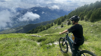
From the parking lot to Blavy you gain 700 m in altitude in about 14 km, and this development with little gradient requires about a couple of hours of pedaling to be done possibly in the cooler hours of the day. The rest of the climb is more rewarding, the gradients are always under 10 percent, but in 6 km or so you climb the remaining 600 m of elevation gain in an hour and a half of leisurely riding. We then continue past the village of Blavy and take the dirt road again, which must be followed ignoring the various branches until we reach our destination: the A.di Viou at m.2078, on the left M. Mary and Becca di Viou, in front M. Emilius and Becca di Nona.
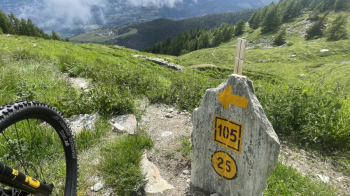
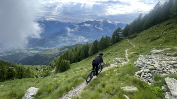
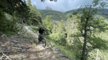
Descent: From the meadow of the alpine pasture, trail 105 starts directly, with a continuous path through the forest, over compact and even rocky terrain with steps and roots (BC, short OC sections) down to Blavy with a few road cuts (at each crossing of the ascent dirt road is marked by a stone with a yellow sign). When you reach Blavy you briefly retrace the paved access road downhill and then rejoin 105 on the right, which is now decidedly easier (MC-BC). Exit near the hairpin bend at elevation 1290 and continue on the splendid, flowing trail (MC, short BC sections, watch out for the stone water drift channels, to be traveled at low speed if not equipped with tubeless!) that will take us to the hamlet of Triet and Tramouail; once we reach the road at Porossan turn left and return on the paved road to Senin.