

 Italiano
 Deutsch
2023/03/04 09:25:10
Creste di Monticolo
Author

Place
Italy - Trentino-Alto Adige/Südtirol, BZ
Km
34,77 km
Elapsed time
04:14:05
Vertical meters
+1 200 mt (225 - 661)
Route difficulty
Landscapes
Last update
2023/03/04 18:45:59
Comments
Description
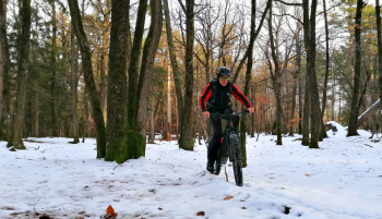
The route goes to discover the Monticolo hill, not the better known part around the lakes, but the higher part, the part towards the Adige valley, passing as much as possible on the narrow path that goes over the ridge, most of the time not tabbed.

It features very steep climbs (with e-bikes you can do them all in the saddle, with regular bikes you'll have to push for a few minutes) and a few rather technical descents, otherwise you're always pedaling inside the Monticolo forest, in rather wild places and without seeing a soul, all just a stone's throw from Bolzano.

Almost all of it off-road. Beautiful views of Lake Monticolo and the adige valley. Doable year-round.
Local weather
Tue 00:00

13 °C
Tue 12:00
16 °C
Wed 00:00

15 °C
Wed 12:00

15 °C
Thu 00:00
13 °C
Thu 12:00

14 °C
Graph
Nearest Routes
61,68 km
Km
+1 220 mt
Vertical meters
Route difficulty
Landscapes
2023/03/05
- Italy - Trentino-Alto Adige/Südtirol, BZ 40,59 km
Km
+770 mt
Vertical meters
Route difficulty
Landscapes

43,62 km
Km
+1 392 mt
Vertical meters
Route difficulty
Landscapes

65,12 km
Km
+2 370 mt
Vertical meters
Route difficulty
Landscapes
37,02 km
Km
+900 mt
Vertical meters
Route difficulty
Landscapes
47,05 km
Km
+1 480 mt
Vertical meters
Route difficulty
Landscapes
20,41 km
Km
+780 mt
Vertical meters
Route difficulty
Landscapes
20,32 km
Km
+400 mt
Vertical meters
Route difficulty
Landscapes
47,22 km
Km
+1 707 mt
Vertical meters
Route difficulty
Landscapes
2023/06/02
- Italy - Trentino-Alto Adige/Südtirol, BZ 40,24 km
Km
+3 321 mt
Vertical meters
Route difficulty
Landscapes