Italiano
 Deutsch
Bolzano - monte Macaion e ritorno

Very nice ride but also very tiring if done with a regular bike without assistance. The tour includes a little bit of everything that an AM tour can offer, nice climbs pedaled never too steep, sections where you have to shoulder, passages a little bit exposed, flowing descents interspersed with sections also very technical and beautiful views.
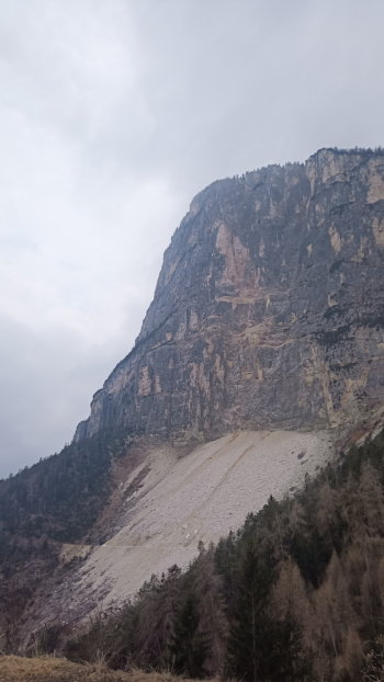
You reach the village of Andriano from where the tour starts and from which you can see Mount Macaion, the goal of the tour is to get to the foot of that beautiful wall.
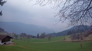
You follow the trail and climb up slopes that are never exaggerated on asphalt and trails. As you go up you get deeper and deeper into the woods and can enjoy beautiful views (unfortunately I caught bad weather yesterday and there was not very good visibility).
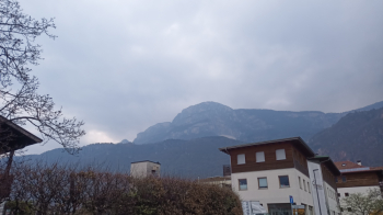
When you arrive at the junction with trail No. 12 before the Tränksteig you can choose whether to go up trail No. 12 by pushing, to cut back, or you can continue along the forestry trail, lengthening the ascent a bit. Once on the Tränksteig you skirt the wall mostly on a forest road, (in some places you will need to push the bike and in one place you will need to shoulder the bike for 40/50 meters) until you get to the foot of Mt. Macaion which greets us with a wonderful view and makes us realize how imposing it is, in fact (the photo does not render).
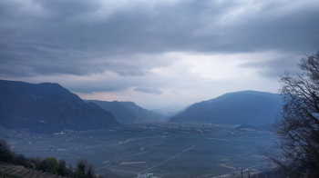
Once you get to the final descent you have to be careful on the first section which is easy but also very exposed, the section in question is however very short. From here starts a beautiful and long flow descent with some very technical sections where you have to be very good at nosepress. The last part of the descent on the other hand is extremely technical on fixed boulders, if you want you can choose other trails to get to the valley, I went scouting and was not aware of the difficulty (too high for me) but those who are very good manage, in my opinion, to get down. Just before the descent there is a beautiful view of Bolzano.