2023/03/04 08:22:36
Plan de Corones dalla val Badia
Author
Place
Italy - Trentino-Alto Adige/Südtirol, BZ
Km
46,45 km
Elapsed time
05:05:25
Vertical meters
+1 450 mt (804 - 2271)
Route difficulty
Landscapes
Last update
2023/03/04 18:32:34
Comments
Description
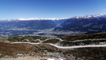
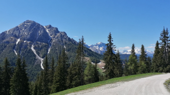
Challenging itinerary both for the ascent at times very steep and for the descent on the Herrensteig trail to Bruneck, but very enjoyable and with splendid views!

From Bruneck/Brunico, climb along back roads in Val Badia among beautiful farmsteads to the Furcia pass. From here forestry with very steep sections to the top of Plan. Very long descent on the path reserved for bikes, for experienced cyclists only. Possible descent on comfortable forest road.

Local weather

°C

°C

°C

°C

°C

°C
Graph
Nearest Routes
66,23 km
Km
+2 220 mt
Vertical meters
Route difficulty
Landscapes
28,90 km
Km
0 mt
Vertical meters
Route difficulty
Landscapes
23,05 km
Km
+1 600 mt
Vertical meters
Route difficulty
Landscapes
2023/03/05
- Italy - Trentino-Alto Adige/Südtirol, BZ 45,98 km
Km
+1 400 mt
Vertical meters
Route difficulty
Landscapes
49,31 km
Km
+1 700 mt
Vertical meters
Route difficulty
Landscapes
27,87 km
Km
+1 571 mt
Vertical meters
Route difficulty
Landscapes
36,75 km
Km
+1 837 mt
Vertical meters
Route difficulty
Landscapes
40,94 km
Km
+2 230 mt
Vertical meters
Route difficulty
Landscapes
34,62 km
Km
+1 720 mt
Vertical meters
Route difficulty
Landscapes
45,86 km
Km
+1 661 mt
Vertical meters
Route difficulty
Landscapes


 Italiano
 Deutsch