HOME RANKINGS CHALLENGES ROUTES POI PLANNING SEARCH LOGIN
Italy - Trentino-Alto Adige/Südtirol, BZ
2023/03/06 16:22:21

Forcella Medesc

11 Downloads
2
 
Author
nonnocarb
(266)
Place
Italy - Trentino-Alto Adige/Südtirol, BZ
Km
49,31 km
Elapsed time
08:54:39
Vertical meters
+1 700 mt (1182 - 2527)
Route difficulty
Landscapes
Last update
2023/03/07 08:02:48
Comments
0
Description

Spectacular itinerary with nothing short of fantastic views and fun trails, although very tough due to steep climbs and long bike-over-bike section.

From San Vigilio you take the high ground to Col d'Ancona and take a long forest trail up and down to the south. You descend on a nice trail to Fontanela and climb back up to the Crusc. You pass the beautiful Armentarola meadows and arrive at the Crusc hut with beautiful views and refreshments.

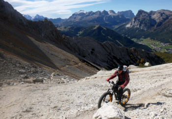
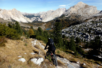
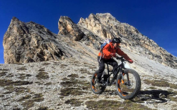
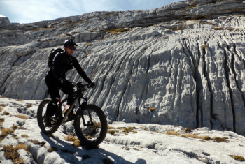
From here on a nice slightly downhill trail to the left fork to the Medesc fork. The trail still has some rideable sections, then you come out of the woods steeply uphill and climb, bike on your back, on the trail with many switchbacks. It is not steep, and some sections you can still pedal. After one last steep section, you reach the beautiful Medesc fork with superpanorama. Now the most beautiful section begins, descending in an almost lunar landscape to the Lavarella refuge, with some climbing.

From the Lavarella (refreshment until mid-October), descend to the Pederù, first on the road and then on the trail. From Pederu (refreshment), you descend to San Vigilio along a beautiful, fast trail through the forest.

Download our free mobile app to send this route to your Garmin device or to navigate it on OSM maps. Android - iOS

Graph

Nearest Routes

2022/09/21
- Italy - Trentino-Alto Adige/Südtirol, BZ
27,87 km
Km
+1 571 mt
Vertical meters
Route difficulty
Landscapes
2023/03/07
- Italy - Trentino-Alto Adige/Südtirol, BZ
nonnocarb
(266)
34,62 km
Km
+1 720 mt
Vertical meters
Route difficulty
Landscapes
2023/03/07
- Italy - Trentino-Alto Adige/Südtirol, BZ
nonnocarb
(266)
28,90 km
Km
0 mt
Vertical meters
Route difficulty
Landscapes
2023/03/05
- Italy - Trentino-Alto Adige/Südtirol, BZ
nonnocarb
(266)
66,23 km
Km
+2 220 mt
Vertical meters
Route difficulty
Landscapes
2023/03/04
- Italy - Trentino-Alto Adige/Südtirol, BZ
nonnocarb
(266)
46,45 km
Km
+1 450 mt
Vertical meters
Route difficulty
Landscapes
2023/03/07
- Italy - Trentino-Alto Adige/Südtirol, BZ
nonnocarb
(266)
23,05 km
Km
+1 600 mt
Vertical meters
Route difficulty
Landscapes
2022/08/04
- Italy - Trentino-Alto Adige/Südtirol, BZ
gmzolenart
(104)
17,91 km
Km
+830 mt
Vertical meters
Route difficulty
Landscapes
2023/02/26
- Italy - Trentino-Alto Adige/Südtirol, BZ
nonnocarb
(266)
24,35 km
Km
+700 mt
Vertical meters
Route difficulty
Landscapes
2023/02/26
- Italy - Trentino-Alto Adige/Südtirol, BZ
nonnocarb
(266)
26,13 km
Km
+960 mt
Vertical meters
Route difficulty
Landscapes
2023/02/26
- Italy - Trentino-Alto Adige/Südtirol, BZ
nonnocarb
(266)
25,21 km
Km
+880 mt
Vertical meters
Route difficulty
Landscapes

0 Comments