
 Italiano
 Deutsch
2023/03/01 10:18:53
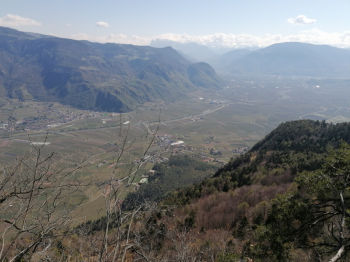
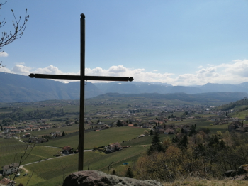
Alta Via di Appiano e Caldaro
Author

Place
Italy - Trentino-Alto Adige/Südtirol, BZ
Km
42,74 km
Elapsed time
04:17:44
Vertical meters
+1 300 mt (190 - 976)
Route difficulty
Landscapes
Last update
2023/03/01 13:24:03
Comments
Hotels
Description
Very fun and scenic route, but also very challenging both for the total elevation gain and the difficulty of some climbs.
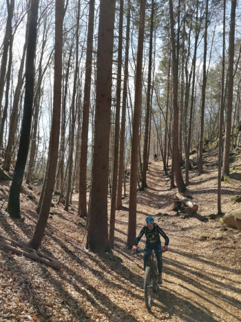
For this reason it is ideal to ride it by e-bike, with normal mtb you need to be very trained. You start right away with a challenging climb to Calvary church, then you go up to the high street of appiano that you ride south with lots of up and down on forestry and fun trails. Then it's down to Lake Kaltern and along forestry and more trails back to the starting point.
Ideal to do in winter if there is little snow or in fall, in spring summer the trails are very hot and too crowded with hikers.
Local weather
Thu 00:00

20 °C
Thu 12:00

27 °C
Fri 00:00

24 °C
Fri 12:00

25 °C
Sat 00:00
20 °C
Sat 12:00
28 °C
Graph
Nearest Routes
92,88 km
Km
+4 200 mt
Vertical meters
Route difficulty
Landscapes
59,06 km
Km
+2 100 mt
Vertical meters
Route difficulty
Landscapes
26,96 km
Km
+1 300 mt
Vertical meters
Route difficulty
Landscapes
50,17 km
Km
+1 000 mt
Vertical meters
Route difficulty
Landscapes
43,62 km
Km
+1 392 mt
Vertical meters
Route difficulty
Landscapes
61,68 km
Km
+1 220 mt
Vertical meters
Route difficulty
Landscapes
2023/03/05
- Italy - Trentino-Alto Adige/Südtirol, BZ 40,59 km
Km
+770 mt
Vertical meters
Route difficulty
Landscapes
34,77 km
Km
+1 200 mt
Vertical meters
Route difficulty
Landscapes
63,83 km
Km
+1 220 mt
Vertical meters
Route difficulty
Landscapes
64,40 km
Km
+2 400 mt
Vertical meters
Route difficulty
Landscapes