HOME RANKINGS CHALLENGES ROUTES NEAR ME PLANNING SEARCH LOGIN
Italy - Trentino-Alto Adige/Südtirol, BZ
2025/11/19 20:48:43

Da Caldaro a San Romedio

1 Downloads
0
 
Share
Author
nonnocarb
(319)
Place
Italy - Trentino-Alto Adige/Südtirol, BZ
Km
64,40 km
Elapsed time
05:06:36
Vertical meters
+2 400 mt (503 - 1850)
Route difficulty
Landscapes
Last update
2025/11/20 09:43:11
Comments
0
Description

Rather long and tiring route, although without any particular technical sections. The difficulties are given more by some very challenging and steep climbs, to be done by pushing with normal bike and pedaling in ebike. Very beautiful views

From the hamlet of S. Antonio, at the start of the funicular to the Mendola, you reach the Mendola pass along a nice, challenging path through the forest and the second part on asphalt.(If you want, you can go up by funicular).

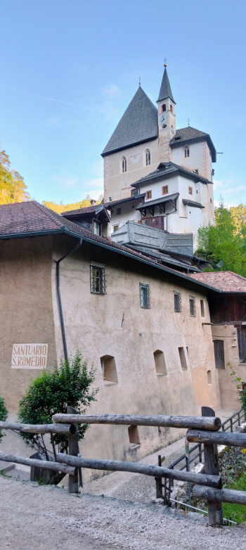
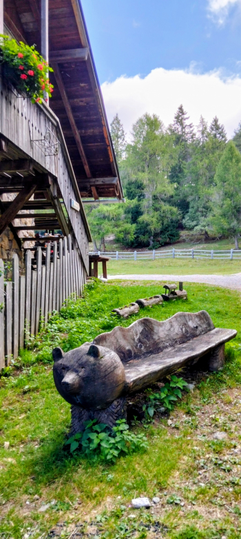
From the pass you descend on a bike path into Val di Non and at the village of Don there is the only somewhat technical section on trail, up to the sanctuary of San Romedio, very nice and with the characteristic bear.

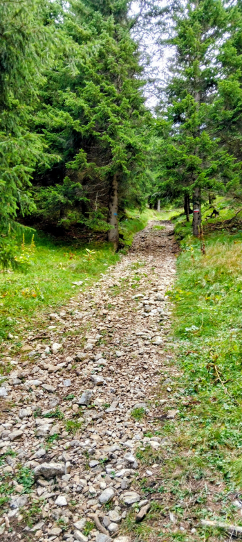
From here we climb to Lake Coredo and then to the Coredo alpine hut. A false-flat section takes us up to the Coredo hut, from here a rough and very steep cartroad takes us to the Coredo pass.

We descend on the forest road (or on trail for the more technical) and then, with a few ups and downs we return to the start.

Download our free mobile app to send this route to your Garmin device or to navigate it on OSM maps. Android - iOS
Local weather
Fr 00:00
18 °C
Fr 12:00
16 °C
Sa 00:00
17 °C
Sa 12:00
19 °C
So 00:00
15 °C
So 12:00
21 °C
Mo 00:00
14 °C
Mo 12:00
21 °C
Di 00:00
17 °C
Di 12:00
23 °C

Graph

Nearest Routes

2023/02/26
- Italy - Trentino-Alto Adige/Südtirol, BZ
nonnocarb
(319)
30,38 km
Km
+1 600 mt
Vertical meters
Route difficulty
Landscapes
2023/03/06
- Italy - Trentino-Alto Adige/Südtirol, BZ
nonnocarb
(319)
50,17 km
Km
+1 000 mt
Vertical meters
Route difficulty
Landscapes
2023/02/06
- Italy - Trentino-Alto Adige/Südtirol, TN
nonnocarb
(319)
17,43 km
Km
+751 mt
Vertical meters
Route difficulty
Landscapes
2023/04/08
- Italy - Trentino-Alto Adige/Südtirol, BZ
26,96 km
Km
+1 300 mt
Vertical meters
Route difficulty
Landscapes
2023/01/30
- Italy - Trentino-Alto Adige/Südtirol, BZ
24,25 km
Km
+1 389 mt
Vertical meters
Route difficulty
Landscapes
2026/05/14
- Italy - Trentino-Alto Adige/Südtirol, BZ
nonnocarb
(319)
59,06 km
Km
+2 100 mt
Vertical meters
Route difficulty
Landscapes
2023/03/01
- Italy - Trentino-Alto Adige/Südtirol, BZ
nonnocarb
(319)
92,88 km
Km
+4 200 mt
Vertical meters
Route difficulty
Landscapes
2023/03/01
- Italy - Trentino-Alto Adige/Südtirol, BZ
nonnocarb
(319)
42,74 km
Km
+1 300 mt
Vertical meters
Route difficulty
Landscapes
2023/03/01
- Italy - Trentino-Alto Adige/Südtirol, BZ
nonnocarb
(319)
63,83 km
Km
+1 220 mt
Vertical meters
Route difficulty
Landscapes
2023/04/20
- Italy - Trentino-Alto Adige/Südtirol, BZ
steve-U
(28)
36,90 km
Km
+1 604 mt
Vertical meters
Route difficulty
Landscapes

0 Comments