
 Italiano
 Deutsch
2026/05/14 16:16:38
Alta via di Caldaro
Author

Place
Italy - Trentino-Alto Adige/Südtirol, BZ
Km
59,06 km
Elapsed time
00:00:00
Vertical meters
+2 100 mt (0 - 1031)
Route difficulty
Landscapes
Last update
2026/05/14 16:20:53
Comments
Hotels
Description
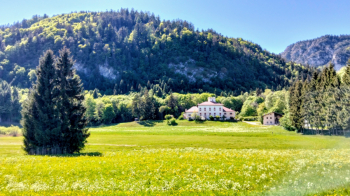
A very scenic route, with no particular technical difficulties but offering stunning views of the Adige Valley and the Dolomites.
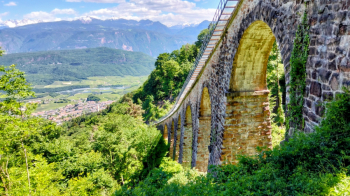
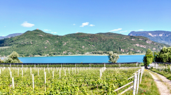
It’s also perfect during the summer months, as the Caldaro High Trail is almost entirely shaded and cool. The return to the valley is also lovely, following the Wine Route with plenty of opportunities for wine tasting.
Ideal for e-bikes due to the numerous fairly steep climbs, but with a bit of experience, it can also be done on a gravel bike.
Local weather
Gio 00:00

20 °C
Gio 12:00

27 °C
Ven 00:00

24 °C
Ven 12:00

25 °C
Sab 00:00
20 °C
Sab 12:00
28 °C
Graph
Nearest Routes
92,88 km
Km
+4 200 mt
Vertical meters
Route difficulty
Landscapes
42,74 km
Km
+1 300 mt
Vertical meters
Route difficulty
Landscapes
26,96 km
Km
+1 300 mt
Vertical meters
Route difficulty
Landscapes
50,17 km
Km
+1 000 mt
Vertical meters
Route difficulty
Landscapes
43,62 km
Km
+1 392 mt
Vertical meters
Route difficulty
Landscapes
61,68 km
Km
+1 220 mt
Vertical meters
Route difficulty
Landscapes
2023/03/05
- Italy - Trentino-Alto Adige/Südtirol, BZ 40,59 km
Km
+770 mt
Vertical meters
Route difficulty
Landscapes
34,77 km
Km
+1 200 mt
Vertical meters
Route difficulty
Landscapes
63,83 km
Km
+1 220 mt
Vertical meters
Route difficulty
Landscapes
64,40 km
Km
+2 400 mt
Vertical meters
Route difficulty
Landscapes