HOME RANKINGS CHALLENGES ROUTES NEAR ME PLANNING SEARCH LOGIN
Italy - Piemonte, TO
2026/10/07 08:45:29

Cesana, Rhuilles, val Gimont

60 Downloads
3
 
Share

Key Takeaways / Scheda Tecnica

Disciplina:
Mountain Bike (MTB)
Percorso:
Cesana, Rhuilles, val Gimont
Località:
Italy - Piemonte, TO
Distanza:
32,21 km
Dislivello Positivo:
+1 550 mt (Quota Min: 1350m - Max: 2376m)
Difficoltà Tecnica:
3/5
Valutazione Panorami:
4/5
Formato Traccia:
GPX Download disponibile
Author
Place
Italy - Piemonte, TO
Km
32,21 km
Elapsed time
00:00:00
Vertical meters
+1 550 mt (1350 - 2376)
Route difficulty
Landscapes
Last update
2026/10/07 11:00:06
Comments
0
Description

A physically demanding route among the many rides you can take in the area. From Cesana, take the bike-and-pedestrian path, then enjoy a pleasant climb to Rhuilles, where a grueling ascent leads toward Colle Chabaud. Leave the dirt road to climb to Colle Begino via a narrow trail that’s exposed in places, with a final stretch that’s steep but entirely rideable. Descend on the dirt road to Lago Nero and then to the Capanna Mautino mountain hut. From here, another tough climb leads to the road coming from Bercia Pass, which takes you near Roc la Luna, the highest point of the route. You then descend along the classic Val Gimont trail, which—with the exception of a few rocky or eroded sections—is of low to moderate difficulty. At the end, you climb back up to Sagnalonga, then descend toward Cesana—initially on the main dirt road, then via some steep shortcuts (which can be avoided), and finally on the wide mule trail that passes by the Casa Alpina. An interesting detail of this route is that, apart from the climb from Capanna Mautino to the next junction, you’ll be riding on roads that are theoretically closed to motorized traffic—a factor that should not be underestimated in this area.
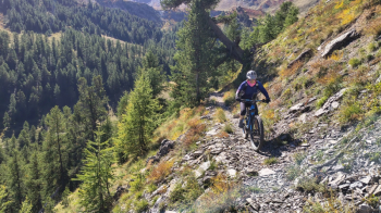
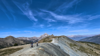
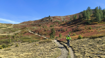
Foto itinerario MTB Cesana, Rhuilles, val Gimont - Italy - Piemonte, TO


Foto itinerario MTB Cesana, Rhuilles, val Gimont - Italy - Piemonte, TO


Foto itinerario MTB Cesana, Rhuilles, val Gimont - Italy - Piemonte, TO

Download our free mobile app to send this route to your Garmin device or to navigate it on OSM maps. Android - iOS
Local weather
Mar 00:00
8 °C
Mar 12:00
10 °C
Mer 00:00
8 °C
Mer 12:00
12 °C
Gio 00:00
4 °C
Gio 12:00
9 °C
Ven 00:00
5 °C
Ven 12:00
6 °C
Sab 00:00
4 °C
Sab 12:00
6 °C

Graph

Nearest Routes

2023/08/16
- Italy - Piemonte, TO
pozzoligio
(93)
50,83 km
Km
+2 037 mt
Vertical meters
Route difficulty
Landscapes
2023/08/12
- Italy - Piemonte, TO
pozzoligio
(93)
52,47 km
Km
+2 557 mt
Vertical meters
Route difficulty
Landscapes
2023/08/16
- Italy - Piemonte, TO
matteof93
(1)
49,90 km
Km
+2 141 mt
Vertical meters
Route difficulty
Landscapes
2026/06/28
- Italy - Piemonte, TO
gmzolenart
(137)
23,31 km
Km
+1 000 mt
Vertical meters
Route difficulty
Landscapes
2024/09/11
- Italy - Piemonte, TO
gmzolenart
(137)
26,57 km
Km
+860 mt
Vertical meters
Route difficulty
Landscapes
2023/06/01
- Italy - Piemonte, TO
Staff
(110)
26,86 km
Km
+1 560 mt
Vertical meters
Route difficulty
Landscapes
28,06 km
Km
+1 213 mt
Vertical meters
Route difficulty
Landscapes
2024/08/22
- France
miciolo
(55)
35,69 km
Km
+1 428 mt
Vertical meters
Route difficulty
Landscapes
2023/09/02
- Italy - Piemonte, TO
gmzolenart
(137)
23,62 km
Km
+1 080 mt
Vertical meters
Route difficulty
Landscapes
2022/09/27
- Italy - Piemonte, TO
pozzoligio
(93)
58,96 km
Km
+2 119 mt
Vertical meters
Route difficulty
Landscapes

0 Comments