Italiano
 Deutsch
S.Calimero
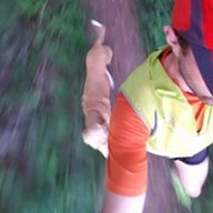
A loop ride starting from Pasturo that heads directly to S. Calimero, bypassing the classic climb from Pialeral. The descent is even more direct, passing through Alpe Tevena and the S. Carlo mule trail. Great for training if you’re short on time; the climb without an e-bike is quite challenging.
ASCENT: From the center of Pasturo, take the small road that climbs alongside the newsstand; soon the road becomes a mule trail with steep gradients in some places—it’s a bit rough in spots but still rideable. In the Monteno area, before connecting with the Pialeral road, it becomes a very steep paved section—just a taste of the climb ahead. Follow the road until you pass a small Alpine troops’ chapel on the right.
Shortly after the church, leave the main road and take a dirt path that immediately steepens and becomes paved. The gradients become steep, but the surface remains good throughout. Follow the road, avoiding all detours; the surface alternates between paved and dirt sections all the way to Prabello, where you’ll find two mountain huts perched on a fantastic ledge. From here, the road becomes a trail through steep pastureland; continue climbing all the way to Upper Prabello, where you’ll come to a trail that you should follow to the right. Once you’ve passed a ruin, a lovely traverse begins that quickly takes you to the little church of St. Calimero.
DESCENT: Take the trail that descends from the church via two steep switchbacks; follow the trail to a small lake, which you’ll leave on your right. From here, continue through a stretch of woods until you reach a steep descent across pastureland. Passing a mountain hut on your right, take a clearly marked trail that turns left into the woods along a nice downhill path.
After passing a steep section, we leave the main trail—which would lead us to Piani di Nava—and take a detour to the right. A somewhat rocky trail leads us to the beautiful S. Carlo mule track, which, with about twenty hairpin turns, takes us to Baiedo.