Italiano
 Deutsch
Giro completo dei Monti di Pasturo

Nice ride, all pedalable and with very little asphalt, touching almost all the pastures of the Pasturo mountains. This is a loop ride so you can start from any point (recommended parking lot Comunità Montana in Locelità Pratobuscante in Barzio, Sagra delle Sagre, in 5 minutes you are on the trail).
Start from the center of Pasturo following the via Castagneti, once you reach the beginning of the agrosilvopastoral road of the Pasturo mountains you turn left to the locality Gorio, which you reach on a cemented/steep road without major inclines. From here, first on fairly ruined cobblestones and then on a path, you reach the Grassi Lunghi valley where, near the Sacro Cuore chapel (parking lot for those going to Grigna and another possible starting point even if on holidays it is not easy to find a place) you turn left and on a dirt road with good bottom you continue to the bottom of the valley. After passing the last mountain hut the road becomes a wide path quite bumpy, but you leave it after about 300 meters by taking a detour to the right that on a nice and fast path on a false plain takes us to the locality Cornisella (last really challenging ramp). From here we continue to the Alpe Cova locality on a mostly cemented road and having reached the "Laghetto" after a few meters we leave the main track, deviating to the left following the dirt road, with a very bumpy surface in some sections, that takes us to the Pialleral locality. From here, following the signs of the "Traversata Bassa"/San Calimero, we descend on a path, in some small sections a bit bumpy but not downhill, to the locality "Prabello di Sotto". Here you take the dirt road and follow it, ignoring the detour to San Calimero, to the ruins of the "Prabello di Sopra" locality. Up to the first two huts it is a dirt road, from there up you follow the track of the old road, now grassland, with somewhat technical stretches and with important slopes.
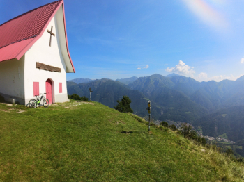
Past the ruins we continue on a nice path, slightly downhill, that quickly takes us to the small church of San Calimero from where we follow the signs to the Riva/Piani di Nava refuge. First part on a path and then on a dirt road with really steep slopes and slightly uneven ground, as soon as the road leaves a bit of breathing space we follow a detour to the left to the Riva refuge( it is possible to continue on the road and arrive directly to the Piani di Nava always however on a steep and not very rewarding road). Up to the refuge it is a path almost all rideable, passing in front of the refuge you take the dirt road that takes you to the green Piani di Nava where on a cemented road you reach the hamlet of Baiedo and return to the start on municipal roads (or on a bike path if you started from the square of the Mountain Community).
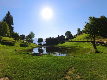
Alpe Cova
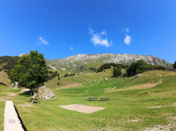
Pialleral
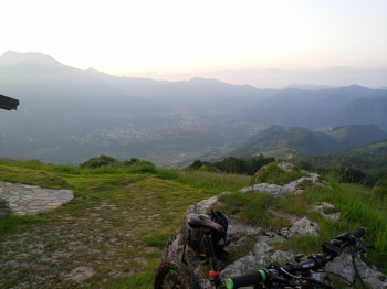
Prabello di Sotto
San Calimero