Italiano
 Deutsch
Maggio - Piani di Artavaggio - sentiero della Vasca

Trail/AM itinerary in Valsassina very nice especially for the views, but with a nice fun downhill intermediate section on beech forest.
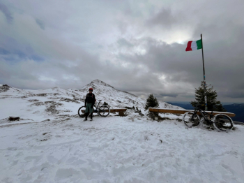
Departure from May from the parking lot next to the cemetery, uphill on a forest road with a bottom always well draining and at times quite steep but nothing worrisome, forest road that leads to the top of the pass of Culmine di San Pietro that divides Valsassina from Val Taleggio, arrived here you descend on asphalt for about 1.5 km to go to take a second forest road that leads to Piani di Artavaggio, arrived here the view is phenomenal, with views of the surrounding mountains and especially Mount Sodadura, with its characteristic pyramid shape. If you wish, you can continue to the Nicola refuge, another 200 meters of rather challenging elevation gain due to the steep and uneven ground but from where you can enjoy an even better view.
Descent on the same steps or if you want you can cut along the tracks of the old ski slopes back to the Piani, continue again on your own steps on the forest road until a hairpin bend where you take the descent of the "tub" (descent much easier than the more famous and infamous of the "Vallone"), we do a small piece on the ridge to deviate to the right on a small valley, here follow the track until we see in front of us a bathtub used as a drinking trough (hence the name of the descent) , short push up and we are on the descent, never challenging but often full of leaves with narrow hairpin bends alternating with fast or rather technical stretches with rocks, a bit of everything in short.
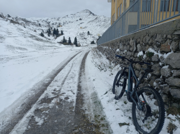
When you reach the bottom on our right there is a short steep uphill section, cross a stream (in case of heavy rains go down instead to the left and you will arrive directly on the road) last downhill section and after some picnic posts and benches you are on the road to the Culmine di San Pietro.
Here you can choose whether to descend directly on asphalt to the starting point, or take a short uphill stretch to go to a downhill forest road that leads to the village of Mezzacca, from here it becomes a path, after the small bridge over the creek a very short and very steep uphill cemented section awaits us that takes us back to the first forest road made, from here down to the starting point.