Italiano
 Deutsch
Traversata bassa delle Grigne - Versione 100% in sella

The ride is a version of the Traversata Bassa delle Grigne with a few detours that makes for a completely rideable ride (at least on E-bike as some sections are a bit challenging). A ride definitely with wonderful views and to be done out of the cold season because although the altitude is not very high some icy sections can be found. The trail follows in a loop starting from the piazzale della Comunità Montana at Prato Buscante in Barzio (Piazzale Sagra delle Sagre). Since it is a loop, it is also possible to start from other points, but there is a convenient parking lot here and it is ideally located to avoid another good climb at the end of the loop.
From the square you start in the direction of Pasturo and as soon as you get to the village (gas station and traffic circle) you turn left in the direction of the agrosilvopastoral road to the mountains of Pasturo. When you get to the beginning of it (up to here all asphalt) you turn left in the direction of Gorio, which you reach on a dirt/gravel road without major inclines. Once here you deviate to the right over cobblestones that are a bit rutted and then on a path in the direction of the Chapel of the Sacred Heart.
Once at the chapel you descend towards Balisio where by bike path (officially closed) you reach Ballabio. As soon as you arrive in the industrial area, after a few tens of meters of provincial road you turn right onto municipal roads and reach the road leading to Piani dei Resinelli. When you reach the "Piani dei Resinelli" sign, turn right in the direction of Rifugio Soldanella where the asphalt road finally ends and on a dirt road going up and down you reach the locality Pian delle Fontane where you take the path that, almost always in the saddle except for short stretches, takes you into the Grassi Lunghi valley (follow the "Traversata Bassa" signs).
At the end of the descent, near a hut we leave the Traversata Bassa trail, deviating to the right (farmhouse signpost) and continuing downhill until the trail widens and on the right is the detour to "Piazza Spinola - Cornisella." Taking the latter on a nice fast path on falsopiano (with the exception of the last ramp that is difficult to pedal without an e-bike) leads us to reach the agrosilvopastoral road that, almost all on cemented ground, takes us to the locality "Alpe Cova". Here a few meters above the "little lake" we leave once again the "Traversata Bassa" signs to take the dirt road, with a fairly bumpy bottom, that takes us to the locality Pialleral with a stupendous view of the Grigna.
From here we follow the signs for the "Traversata Bassa" and on path we descend to the locality "Prabello". After a few hundred meters of dirt road instead of following the signs for "San Calimero" we continue on the dirt road that, after passing two huts, becomes practically a rather bumpy meadow and takes us to the locality "Prabello di sopra". Passing aside to the ruins on a slightly downhill path we quickly reach the characteristic little church dedicated to "San Calimero", also from here a wonderful view. Leaving the little church on the left we take the path leading to the Riva/Piani di Nava Refuge. After a short while the path becomes a dirt road that will test the braking system because of its gradient, and when the road starts to give us some breathing space we follow the detour to the right to the Riva hut. Once at the hut we take the road, mostly cemented, that takes us to Primaluna where, on the beautiful Valsassina bike path (always very crowded but which makes us avoid the traffic), we return to the start.
The track does not present any particular difficulties and all of them can be avoided with a few steps on foot; moreover, once we get to Località Cornisella, it is possible to shorten the route by taking the various roads that lead from the mountains of Pasturo to the village.
N.B. The trail does not start from the above mentioned square as it is a route for me starting from home.
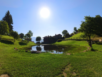
Pian delle Fontane
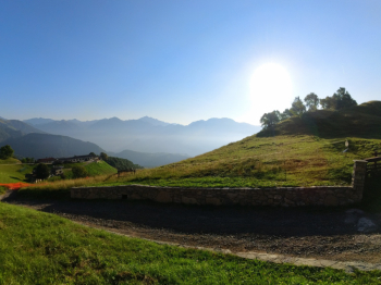
Alpe Cova
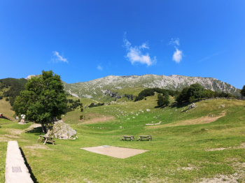
Grigna
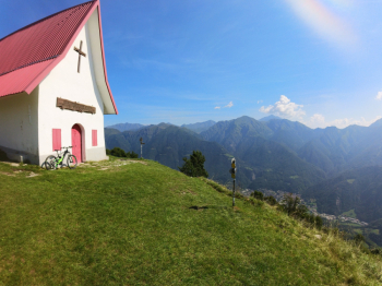
San Calimero