HOME RANKINGS CHALLENGES ROUTES NEAR ME PLANNING SEARCH LOGIN
Italy - Trentino-Alto Adige/Südtirol, TN
2026/08/25 21:57:37

Cima Canfedin e Paganella

6 Downloads
0
 
Share

Key Takeaways / Scheda Tecnica

Disciplina:
Mountain Bike (MTB)
Percorso:
Cima Canfedin e Paganella
Località:
Italy - Trentino-Alto Adige/Südtirol, TN
Distanza:
37,35 km
Dislivello Positivo:
+1 640 mt (Quota Min: 825m - Max: 2119m)
Difficoltà Tecnica:
4/5
Valutazione Panorami:
4/5
Formato Traccia:
GPX Download disponibile
Author
miciolo
(55)
Place
Italy - Trentino-Alto Adige/Südtirol, TN
Km
37,35 km
Elapsed time
07:45:03
Vertical meters
+1 640 mt (825 - 2119)
Route difficulty
Landscapes
Last update
2026/08/25 22:27:08
Comments
0
Description

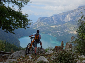
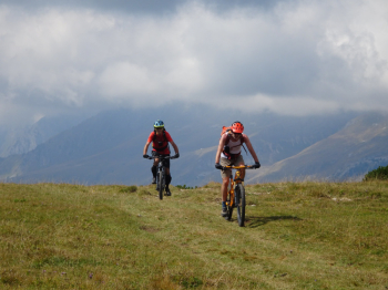
A challenging hike on the Paganella Plateau, starting from Andalo. We descend along the beautiful bike path (S1) until we reach the final section of the Secret Trail (S4), which takes us right to the shore of Lake Molveno. We’ll follow a section of the trail along the lake’s left shore, then cross the paved road and begin climbing up a dirt road with some concrete sections. The first few kilometers are really tough, with steep grades that are rideable if you’re in good shape. As we climb, the gradient eases but remains challenging throughout.

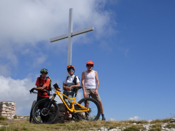
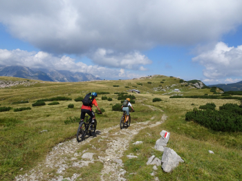
You’ll reach Dosson, the top station of the ski lifts, where the trail levels out and you’ll need to watch out for the many tourists with children in tow. We continue climbing on a pleasant dirt road to Passo San Giacomo, where the views open up to include the Brenta Dolomites—if they aren’t hidden by clouds. With one final push, we reach Cima Canfedin at 2,034 meters, with beautiful views of the Val d’Adige below.

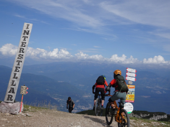
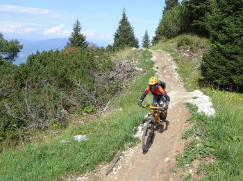
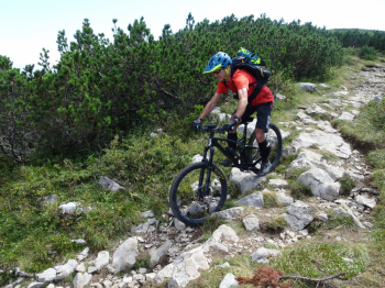
We retrace our steps for a few hundred linear meters to take the traverse (S3 with S4 sections) that connects to the dirt road leading to Cima Paganella. We pass the Sant’Antonio Pass and the reservoir used for snowmaking and reach Cima Paganella at 2,120 meters via very steep concrete ramps. After a well-deserved break at the mountain hut, we’re ready to descend into the valley using the Bike Park trails. We start with the Interstellar trail (S2), characterized by a rocky surface with tight turns and boardwalks. Next is the Supernatural trail (S2), which flows a bit more smoothly than the previous one. We continue on the Hustle & Flow trail (S1), which is much more relaxed than the previous ones. We finish with the Willy Wonka trail (S1), a spectacular mix of berms, boardwalks, bumps, and jumps.

I’ll say it again: the climbs, if done on a mountain bike—as we did—are really tough. If you don’t want to pedal but just want to have fun, take the lifts!

For more details, check out the photo report.
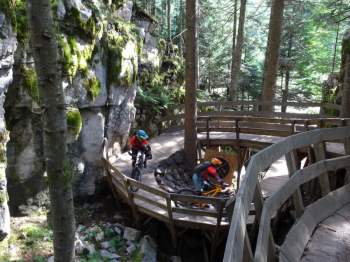
Foto itinerario MTB Cima Canfedin e Paganella - Italy - Trentino-Alto Adige/Südtirol, TNFoto itinerario MTB Cima Canfedin e Paganella - Italy - Trentino-Alto Adige/Südtirol, TNFoto itinerario MTB Cima Canfedin e Paganella - Italy - Trentino-Alto Adige/Südtirol, TNFoto itinerario MTB Cima Canfedin e Paganella - Italy - Trentino-Alto Adige/Südtirol, TNFoto itinerario MTB Cima Canfedin e Paganella - Italy - Trentino-Alto Adige/Südtirol, TNFoto itinerario MTB Cima Canfedin e Paganella - Italy - Trentino-Alto Adige/Südtirol, TNFoto itinerario MTB Cima Canfedin e Paganella - Italy - Trentino-Alto Adige/Südtirol, TNFoto itinerario MTB Cima Canfedin e Paganella - Italy - Trentino-Alto Adige/Südtirol, TN

Download our free mobile app to send this route to your Garmin device or to navigate it on OSM maps. Android - iOS
Local weather
Tue 00:00
10 °C
Tue 12:00
13 °C
Wed 00:00
10 °C
Wed 12:00
14 °C
Thu 00:00
9 °C
Thu 12:00
9 °C
Fri 00:00
7 °C
Fri 12:00
8 °C
Sat 00:00
7 °C
Sat 12:00
6 °C

Graph

Nearest Routes

2025/09/13
- Italy - Trentino-Alto Adige/Südtirol, TN
steve-U
(29)
71,77 km
Km
+640 mt
Vertical meters
Route difficulty
Landscapes
2024/12/18
- Italy - Trentino-Alto Adige/Südtirol, TN
biciclitu
(34)
12,39 km
Km
+1 350 mt
Vertical meters
Route difficulty
Landscapes
2025/09/30
- Italy - Trentino-Alto Adige/Südtirol, TN
biciclitu
(34)
21,01 km
Km
+1 600 mt
Vertical meters
Route difficulty
Landscapes
2024/07/07
- Italy - Trentino-Alto Adige/Südtirol, TN
marco
(195)
39,40 km
Km
+189 mt
Vertical meters
Route difficulty
Landscapes
2025/06/26
- Italy - Trentino-Alto Adige/Südtirol, TN
steve-U
(29)
11,62 km
Km
+229 mt
Vertical meters
Route difficulty
Landscapes
2022/09/22
- Italy - Trentino-Alto Adige/Südtirol, TR
78,77 km
Km
+6 258 mt
Vertical meters
Route difficulty
Landscapes
2026/05/03
- Italy - Trentino-Alto Adige/Südtirol, TN
marco
(195)
27,11 km
Km
+1 447 mt
Vertical meters
Route difficulty
Landscapes
2023/01/07
- Italy - Trentino-Alto Adige/Südtirol, TN
gaspa91
(4)
32,43 km
Km
+1 350 mt
Vertical meters
Route difficulty
Landscapes
2025/09/15
- Italy - Trentino-Alto Adige/Südtirol, TN
Robibz
(25)
34,90 km
Km
+1 455 mt
Vertical meters
Route difficulty
Landscapes
2022/11/01
- Italy - Trentino-Alto Adige/Südtirol, TN
nonnocarb
(324)
38,08 km
Km
+1 272 mt
Vertical meters
Route difficulty
Landscapes

0 Comments