
 Italiano
 Deutsch
Bocca delle Scalace e Monte Corno (Paganella Bike 803)

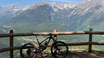
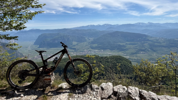
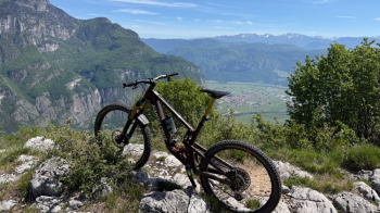
This route begins at the Brenta Rosso B&B in Fai della Paganella. You climb up to Santél and take the steep concrete road which, after about 200 meters of fairly strenuous climbing, levels off and leads you to this scenic viewpoint.
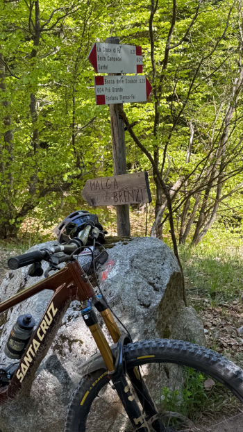
Continue through the woods, ignoring the detour to Monte Corno 803—which we’ll take on our next trip—and climb gently without any major steep sections until you reach this fork:
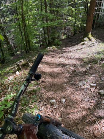
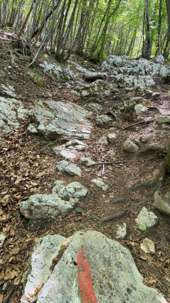
The trail is a blast because it runs through the woods with few sections over fixed rocks (max S3 at one point). Although steep, the grip is excellent.
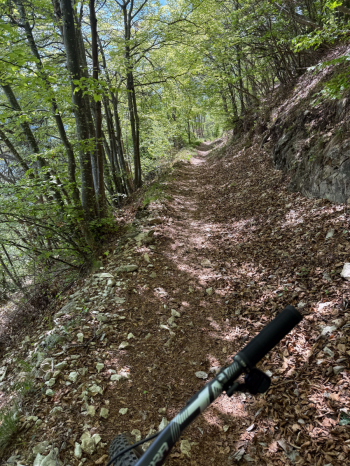
Things change when you reach the second part of the trail, which follows an old military road/path overlooking the Val d’Adige with beautiful views.
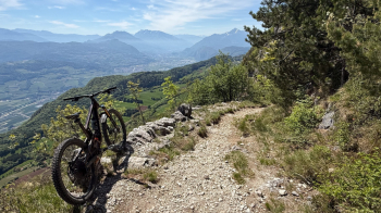
The trail takes on a Dolomite-like character, with lots of boulders and rocks, but it isn’t difficult and isn’t steep except at one point, the one below this rock face:
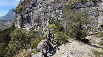
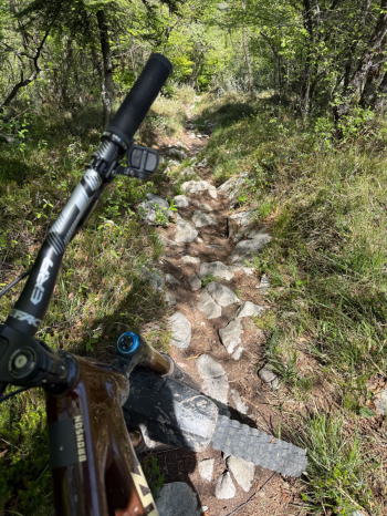
If in doubt, push through those few meters (S3). I rode this route on Saturday, May 3, around 11:30 a.m. and didn’t see a soul. This brings you to Fai, and from there you head up toward Santél, where you retrace the climb for the second time to the junction for the 803/Monte Corno, an official Paganella Bike trail. The first short section of the trail is just a shortcut that drops you back onto the dirt road. Follow it on a slight incline to the start of the actual trail, which immediately reveals its true character: a steep, poorly maintained trail, full of rocks embedded in the ground that make choosing a line difficult, but above all, in early May 2026, full of branches and leaves.
We arrive at a scenic viewpoint overlooking the Val di Non, where we can catch our breath.
The “Sentiero EE” (Expert Hikers) sign foreshadows what lies ahead: a frenzy of steep sections, rocks, and, once again, leaves and branches that make traversing the trail very challenging (S3/S4). Personally, I wouldn’t recommend it until someone comes by to clear it. I can’t even imagine what it’s like when wet. Steve Ude confirms that, even when clear, it’s not a fun trail.
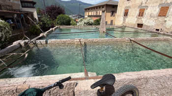
We arrive above Spormaggiore, and here DO NOT follow the trail that crosses the dirt road and continues along the path, because it is NOT rideable. Follow the road and rejoin the trail in the village. Here, a magnificent fountain awaits us.
For the climb to Fai, I strongly recommend not following the first part of the trail that attempts to go around the Wildlife Park by following signs 803, but instead taking the paved road right away. Once you rejoin the trail, follow it to Santél, where it ends at the restaurant below the Fai cable car for a well-deserved (and very good) pizza with beer.
In short, the second part of the route leaves a bad taste in your mouth, while the first is truly spectacular and well worth the hike. Since this is a loop, you can decide for yourself whether to tackle Monte Corno. I repeat, unless they fix it, it’s not worth your time. The difficulty level refers to the first part of the loop.


