

 Italiano
 Deutsch
2026/08/20 18:00:40
Da Merano alla malga di Romeno
Author

Place
Italy - Trentino-Alto Adige/Südtirol, BZ
Km
100,58 km
Elapsed time
00:00:00
Vertical meters
+2 400 mt (0 - 0)
Route difficulty
Landscapes
Last update
2026/08/21 09:07:40
Comments
Description
This is a very long route but not particularly technically challenging, since it follows paved roads and forest roads for the most part. The views from above are stunning.
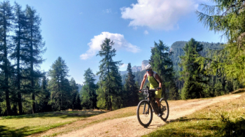
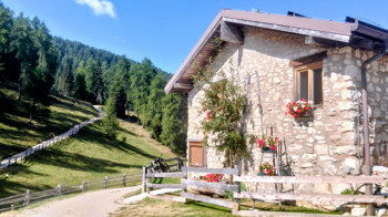
From Merano, you climb to the Palade Pass (you can also take dirt roads if you prefer), descend into the Val di Non to Fondo and Cavareno, and then from Amblar, you climb through the woods all the way to the Romeno mountain hut, which offers excellent refreshments.
Descend to the Mendola Pass, and then at the Matschatsch hairpin turn, take the forest road down to Missiano, where you’ll find the only trail of the day—though it presents no particular difficulties. Then follow the foothill road to Lana and on to Merano.
Local weather
Mar 00:00

15 °C
Mar 12:00

17 °C
Mer 00:00

14 °C
Mer 12:00

14 °C
Gio 00:00
12 °C
Gio 12:00

14 °C

Graph
Nearest Routes
94,24 km
Km
+2 400 mt
Vertical meters
Route difficulty
Landscapes
2025/11/10
- Italy - Trentino-Alto Adige/Südtirol, BZ 65,30 km
Km
+1 800 mt
Vertical meters
Route difficulty
Landscapes
65,11 km
Km
+1 800 mt
Vertical meters
Route difficulty
Landscapes
105,14 km
Km
+3 200 mt
Vertical meters
Route difficulty
Landscapes
37,99 km
Km
+1 520 mt
Vertical meters
Route difficulty
Landscapes
73,40 km
Km
+3 000 mt
Vertical meters
Route difficulty
Landscapes
2023/03/04
- Italy - Trentino-Alto Adige/Südtirol, BZ 58,93 km
Km
+3 000 mt
Vertical meters
Route difficulty
Landscapes
52,87 km
Km
+1 754 mt
Vertical meters
Route difficulty
Landscapes
48,57 km
Km
+1 550 mt
Vertical meters
Route difficulty
Landscapes
93,54 km
Km
+2 520 mt
Vertical meters
Route difficulty
Landscapes