HOME RANKINGS CHALLENGES ROUTES NEAR ME PLANNING SEARCH LOGIN
Italy - Trentino-Alto Adige/Südtirol, BZ
2025/11/10 18:01:59

Merano Nalles Sirmiano Plazzoles Foiana

3 Downloads
0
 
Share

Key Takeaways / Scheda Tecnica

Disciplina:
Mountain Bike (MTB)
Percorso:
Merano Nalles Sirmiano Plazzoles Foiana
Località:
Italy - Trentino-Alto Adige/Südtirol, BZ
Distanza:
65,30 km
Dislivello Positivo:
+1 800 mt (Quota Min: 257m - Max: 1292m)
Difficoltà Tecnica:
1/5
Valutazione Panorami:
3/5
Formato Traccia:
GPX Download disponibile
Author
nonnocarb
(324)
Place
Italy - Trentino-Alto Adige/Südtirol, BZ
Km
65,30 km
Elapsed time
05:09:43
Vertical meters
+1 800 mt (257 - 1292)
Route difficulty
Landscapes
Last update
2025/11/10 22:00:14
Comments
0
Description

Highly satisfying route, with no particular technical difficulties, also doable by gravel, with lots of up and down and beautiful views of the Adige Valley.
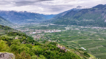
Foto itinerario MTB Merano Nalles Sirmiano Plazzoles Foiana - Italy - Trentino-Alto Adige/Südtirol, BZ

From Merano you reach Nalles via secondary roads, then climb up to Sirmiano and via forest roads in the forest you pass Grissiano, Plazzoles and Foiana.
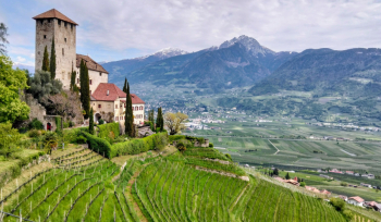
Foto itinerario MTB Merano Nalles Sirmiano Plazzoles Foiana - Italy - Trentino-Alto Adige/Südtirol, BZ

From here you climb to the beautiful little church of San Ippolito with refreshments and splendid views and then descend to Merano.
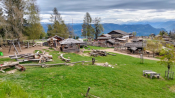
Foto itinerario MTB Merano Nalles Sirmiano Plazzoles Foiana - Italy - Trentino-Alto Adige/Südtirol, BZ

Download our free mobile app to send this route to your Garmin device or to navigate it on OSM maps. Android - iOS
Local weather
Tue 00:00
15 °C
Tue 12:00
17 °C
Wed 00:00
15 °C
Wed 12:00
14 °C
Thu 00:00
13 °C
Thu 12:00
15 °C
Fri 00:00
10 °C
Fri 12:00
12 °C
Sat 00:00
10 °C
Sat 12:00
13 °C

Graph

Nearest Routes

2025/04/29
- Italy - Trentino-Alto Adige/Südtirol, BZ
nonnocarb
(324)
65,11 km
Km
+1 800 mt
Vertical meters
Route difficulty
Landscapes
2024/05/13
- Italy - Trentino-Alto Adige/Südtirol, BZ
nonnocarb
(324)
94,24 km
Km
+2 400 mt
Vertical meters
Route difficulty
Landscapes
2026/08/20
- Italy - Trentino-Alto Adige/Südtirol, BZ
nonnocarb
(324)
100,58 km
Km
+2 400 mt
Vertical meters
Route difficulty
Landscapes
2026/08/20
- Italy - Trentino-Alto Adige/Südtirol, BZ
nonnocarb
(324)
73,40 km
Km
+3 000 mt
Vertical meters
Route difficulty
Landscapes
2023/03/04
- Italy - Trentino-Alto Adige/Südtirol, BZ
nonnocarb
(324)
58,93 km
Km
+3 000 mt
Vertical meters
Route difficulty
Landscapes
2022/10/28
- Italy - Trentino-Alto Adige/Südtirol, BZ
nonnocarb
(324)
52,87 km
Km
+1 754 mt
Vertical meters
Route difficulty
Landscapes
2023/03/02
- Italy - Trentino-Alto Adige/Südtirol, BZ
nonnocarb
(324)
105,14 km
Km
+3 200 mt
Vertical meters
Route difficulty
Landscapes
2023/03/01
- Italy - Trentino-Alto Adige/Südtirol, BZ
nonnocarb
(324)
43,62 km
Km
+1 615 mt
Vertical meters
Route difficulty
Landscapes
2023/03/05
- Italy - Trentino-Alto Adige/Südtirol, BZ
nonnocarb
(324)
93,54 km
Km
+2 520 mt
Vertical meters
Route difficulty
Landscapes
2023/03/07
- Italy - Trentino-Alto Adige/Südtirol, BZ
nonnocarb
(324)
33,38 km
Km
+1 600 mt
Vertical meters
Route difficulty
Landscapes

0 Comments