

 Italiano
 Deutsch
2026/07/19 11:33:45
Pourrieres-Assietta-Ciantiplagna
Author

Place
Italy - Piemonte, TO
Km
38,90 km
Elapsed time
00:00:00
Vertical meters
+1 600 mt (1413 - 2779)
Route difficulty
Landscapes
Last update
2026/07/19 12:14:13
Comments
Description
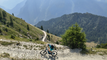
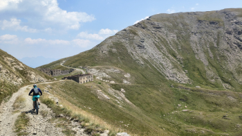
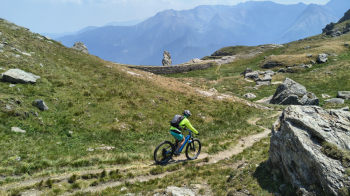
A spectacular and classic route along the high-altitude military road straddling Val Susa and Val Chisone. You should definitely do this on Wednesdays or Saturdays in July and August if you don’t want to breathe in dust while stuck behind motorcycles and cars. The route is straightforward, and aside from the final descent from Pian dell’Alpe, it’s even doable on a gravel bike. No problem with e-bikes either. The only water stop is Balboutet.
Local weather
Mar 00:00

9 °C
Mar 12:00

7 °C
Mer 00:00
8 °C
Mer 12:00

13 °C
Gio 00:00

4 °C
Gio 12:00
9 °C
Graph
Nearest Routes

56,49 km
Km
+1 450 mt
Vertical meters
Route difficulty
Landscapes
20,07 km
Km
+1 191 mt
Vertical meters
Route difficulty
Landscapes
22,83 km
Km
+1 113 mt
Vertical meters
Route difficulty
Landscapes
25,74 km
Km
+1 019 mt
Vertical meters
Route difficulty
Landscapes
54,43 km
Km
+2 160 mt
Vertical meters
Route difficulty
Landscapes
81,05 km
Km
+2 758 mt
Vertical meters
Route difficulty
Landscapes
25,01 km
Km
+1 177 mt
Vertical meters
Route difficulty
Landscapes
61,32 km
Km
+2 620 mt
Vertical meters
Route difficulty
Landscapes
80,93 km
Km
+2 150 mt
Vertical meters
Route difficulty
Landscapes
68,38 km
Km
+2 000 mt
Vertical meters
Route difficulty
Landscapes