Italiano
 Deutsch
Rifugio Selleries - sentiero Agostino Benedetto

Nearly fall tour, Friday, September 9, taking up the cannon trail in the uphill portion.
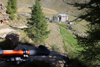
The trail to Rifugio Selleries can be found on the web, the one for the Agostino Benedetto trail still cannot. The ascent from Depot (by the way, the car is best parked here, in Fenestrelle in theory the parking lots are timed, 2 hours) is 8 km of asphalt to gain 700 meters of elevation gain and then another 5 and a half km for another 300 meters of elevation gain to Rifugio Selleries, open year-round and a meeting place for snowshoers in snowy winters.
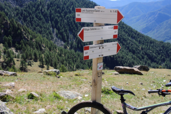
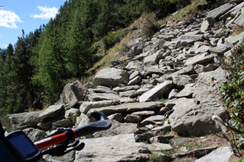
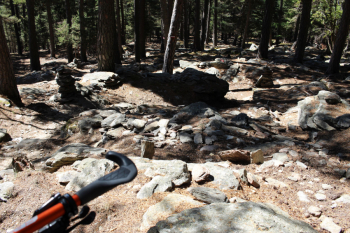
Descent: you can opt for the little path that descends steeply on the orographic right from the Refuge or take the wide loop on the left, which is a bit ravishing today due to tall grass. Continuing toward Seleiraut you cross the sign indicating Larà superiore Saret h.1.45 and below Sentiero Agostino Benedetto. The trail was inaugurated by the Pinerolo CAI in June 2021 , in memory of a member who passed away by mtb in October 2018. It is a trail about 3.7 km long, with some trial sections in the initial part and in some climbs. The trail is excellently marked, there are some nice wooden walkways, some very well done cuts in the slope.
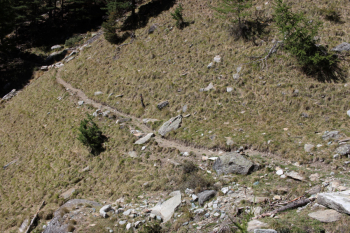
The small toboggan in the woods with the little walls is also very satisfying.
On the way up to the Selleries, several warning signs for the presence of grazing animals and related guard dogs can be glimpsed. Today they were heard but not seen, except at Upper Larà, it was just the two of us, I saw it and the big white dog about 50 meters below intent on munching something didn't hear me, beginner's luck.
Fraternali publisher no. 5 Val Germanasca, Val Chisone Trail map (1:25,000)