
 Italiano
 Deutsch
2025/11/21 09:25:50
Talle e Videgg da Merano
Author

Place
Italy - Trentino-Alto Adige/Südtirol, BZ
Km
53,14 km
Elapsed time
04:01:53
Vertical meters
+1 900 mt (293 - 1852)
Route difficulty
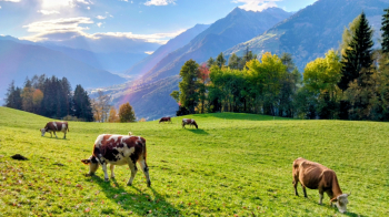
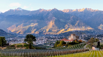
Landscapes
Last update
2025/11/21 09:34:42
Comments
Hotels
Description
Challenging route due to long climbs, but very scenic and free of technical difficulties, also suitable for gravel.
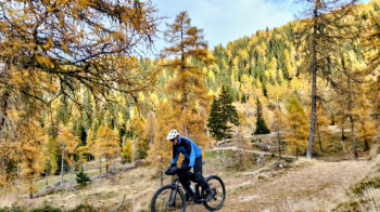
From Merano, follow the beautiful Val Passiria bike path to Saltusio, then climb to Talle. From here you climb up a forest road in the middle of a beautiful forest to the Gompm Alm (refreshment stop).
You then take a forest road with lots of ups and downs to Videgg (refreshment). From here you descend to Merano, with a final detour to castel Gatto.
Local weather
Thu 00:00

21 °C
Thu 12:00

29 °C
Fri 00:00

26 °C
Fri 12:00

26 °C
Sat 00:00
20 °C
Sat 12:00
29 °C
Graph
Nearest Routes
79,24 km
Km
+2 400 mt
Vertical meters
Route difficulty
Landscapes
49,70 km
Km
+1 600 mt
Vertical meters
Route difficulty
Landscapes
52,00 km
Km
+1 080 mt
Vertical meters
Route difficulty
Landscapes
40,77 km
Km
+1 500 mt
Vertical meters
Route difficulty
Landscapes
2024/07/25
- Italy - Trentino-Alto Adige/Südtirol, BZ 81,06 km
Km
+2 150 mt
Vertical meters
Route difficulty
Landscapes
2023/03/04
- Italy - Trentino-Alto Adige/Südtirol, BZ 96,84 km
Km
+2 220 mt
Vertical meters
Route difficulty
Landscapes
2023/03/01
- Italy - Trentino-Alto Adige/Südtirol, BZ 69,97 km
Km
+1 740 mt
Vertical meters
Route difficulty
Landscapes
2024/09/18
- Italy - Trentino-Alto Adige/Südtirol, BZ 56,20 km
Km
+2 300 mt
Vertical meters
Route difficulty
Landscapes
2023/02/26
- Italy - Trentino-Alto Adige/Südtirol, BZ 48,20 km
Km
+1 800 mt
Vertical meters
Route difficulty
Landscapes
64,38 km
Km
+2 300 mt
Vertical meters
Route difficulty
Landscapes