HOME RANKINGS CHALLENGES ROUTES NEAR ME PLANNING SEARCH LOGIN
Italy - Trentino-Alto Adige/Südtirol, BZ
2024/09/18 14:02:45

Da Merano a Falkomai in senso orario

3 Downloads
0
 
Share

Key Takeaways / Scheda Tecnica

Disciplina:
Mountain Bike (MTB)
Percorso:
Da Merano a Falkomai in senso orario
Località:
Italy - Trentino-Alto Adige/Südtirol, BZ
Distanza:
56,20 km
Dislivello Positivo:
+2 300 mt (Quota Min: 260m - Max: 2170m)
Difficoltà Tecnica:
4/5
Valutazione Panorami:
3/5
Formato Traccia:
GPX Download disponibile
Author
nonnocarb
(324)
Place
Italy - Trentino-Alto Adige/Südtirol, BZ
Km
56,20 km
Elapsed time
06:04:52
Vertical meters
+2 300 mt (260 - 2170)
Route difficulty
Landscapes
Last update
2024/09/19 08:57:25
Comments
0
Description

Still in the "let's redo the rides of many years ago by adapting the route for ebikes" series, here is a fabulous ride, with very steep trails but almost all pedaled (minus a push part).
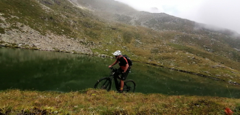
Foto itinerario MTB Da Merano a Falkomai in senso orario - Italy - Trentino-Alto Adige/Südtirol, BZ

From Merano we climb up through the Val d'Ultimo on very steep back roads, ebike only (for bikes detours on site) and arrive at the Falkomai hut below. Here begins the challenging part, partly pedaled and partly pushed, with two short exposed sections with steel rope, less than half an hour in all.
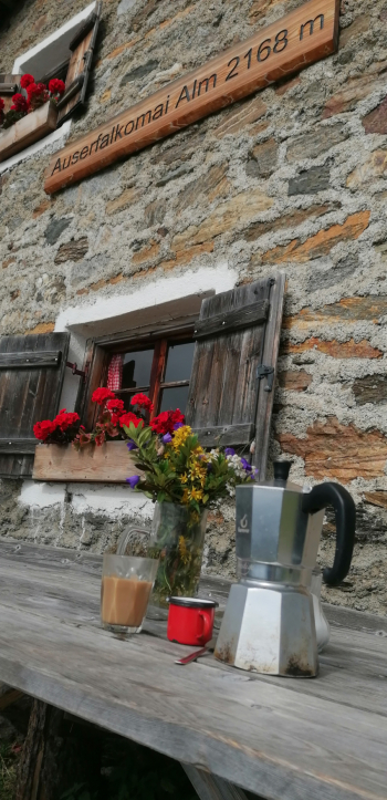
Foto itinerario MTB Da Merano a Falkomai in senso orario - Italy - Trentino-Alto Adige/Südtirol, BZ

You arrive at Lake Falkomai, with thousands of tadpoles, and then at the alp of the same name with refreshments and beautiful views.
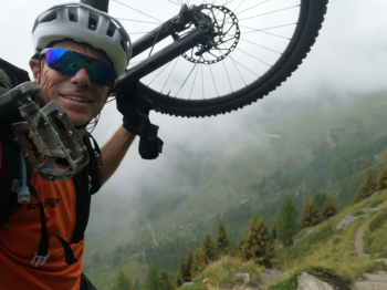
Foto itinerario MTB Da Merano a Falkomai in senso orario - Italy - Trentino-Alto Adige/Südtirol, BZ

From here a very long and very enjoyable trail, with many ups and downs, leads to San Vigilio. Very varied final descent from 1400 meters of elevation gain, with super challenging finish, on the Stuanbruch Trail to Merano.
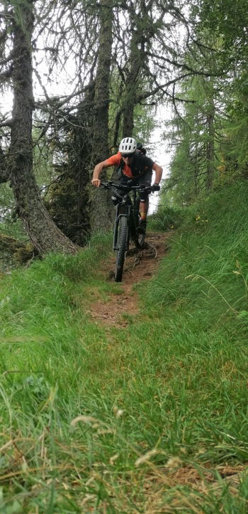
Foto itinerario MTB Da Merano a Falkomai in senso orario - Italy - Trentino-Alto Adige/Südtirol, BZ

Download our free mobile app to send this route to your Garmin device or to navigate it on OSM maps. Android - iOS
Local weather
Tue 00:00
15 °C
Tue 12:00
17 °C
Wed 00:00
15 °C
Wed 12:00
14 °C
Thu 00:00
13 °C
Thu 12:00
15 °C
Fri 00:00
10 °C
Fri 12:00
12 °C
Sat 00:00
10 °C
Sat 12:00
13 °C

Graph

Nearest Routes

2024/09/04
- Italy - Trentino-Alto Adige/Südtirol, BZ
nonnocarb
(324)
64,42 km
Km
+1 900 mt
Vertical meters
Route difficulty
Landscapes
2025/11/15
- Italy - Trentino-Alto Adige/Südtirol, BZ
nonnocarb
(324)
64,38 km
Km
+2 300 mt
Vertical meters
Route difficulty
Landscapes
2023/02/26
- Italy - Trentino-Alto Adige/Südtirol, BZ
nonnocarb
(324)
48,20 km
Km
+1 800 mt
Vertical meters
Route difficulty
Landscapes
2023/03/04
- Italy - Trentino-Alto Adige/Südtirol, BZ
nonnocarb
(324)
96,84 km
Km
+2 220 mt
Vertical meters
Route difficulty
Landscapes
2023/03/01
- Italy - Trentino-Alto Adige/Südtirol, BZ
nonnocarb
(324)
69,97 km
Km
+1 740 mt
Vertical meters
Route difficulty
Landscapes
2023/03/04
- Italy - Trentino-Alto Adige/Südtirol, BZ
nonnocarb
(324)
47,13 km
Km
+1 100 mt
Vertical meters
Route difficulty
Landscapes
2024/07/25
- Italy - Trentino-Alto Adige/Südtirol, BZ
nonnocarb
(324)
81,06 km
Km
+2 150 mt
Vertical meters
Route difficulty
Landscapes
2024/11/18
- Italy - Trentino-Alto Adige/Südtirol, BZ
nonnocarb
(324)
44,14 km
Km
+2 100 mt
Vertical meters
Route difficulty
Landscapes
2023/03/05
- Italy - Trentino-Alto Adige/Südtirol, BZ
nonnocarb
(324)
36,69 km
Km
+1 310 mt
Vertical meters
Route difficulty
Landscapes
2023/03/04
- Italy - Trentino-Alto Adige/Südtirol, BZ
nonnocarb
(324)
71,62 km
Km
+1 820 mt
Vertical meters
Route difficulty
Landscapes

0 Comments