
 Italiano
 Deutsch
2025/11/20 09:54:29
Rankipino val di Non
Author

Place
Italy - Trentino-Alto Adige/Südtirol, TN
Km
87,74 km
Elapsed time
04:52:09
Vertical meters
+2 200 mt (555 - 1517)
Route difficulty
Landscapes
Last update
2025/11/20 09:57:49
Comments
Hotels
Description
The Rankipino route is a beautiful route to discover Alta val di Non, all pedalable and with no particular technical difficulties.
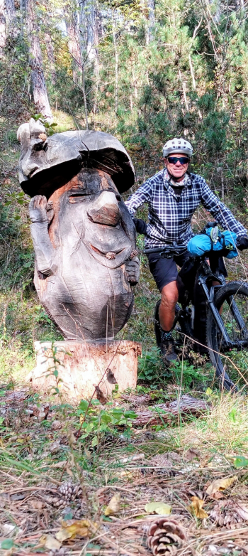
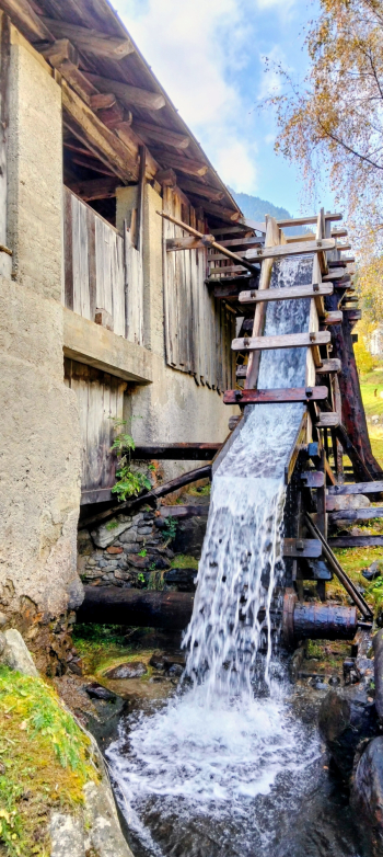
It starts from the Mostizzolo bridge at the beginning of the Val di Sole and goes all the way to the Palade pass, with lots of up and down and many scenic sections, passing through small villages and typical places such as old mills and old fountains, always in the woods and along bicycle, forest or secondary roads.
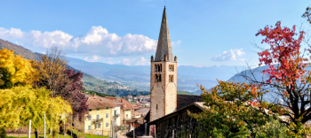
To close the loop route, I started from Palade pass and passed through Fondo, Cloz and Revò to arrive in Mostizzolo.
Local weather
Thu 00:00

14 °C
Thu 12:00
21 °C
Fri 00:00

17 °C
Fri 12:00
18 °C
Sat 00:00
15 °C
Sat 12:00

21 °C

Graph
Nearest Routes
2023/02/26
- Italy - Trentino-Alto Adige/Südtirol, BZ 26,94 km
Km
+1 020 mt
Vertical meters
Route difficulty
Landscapes
21,72 km
Km
+880 mt
Vertical meters
Route difficulty
Landscapes
41,08 km
Km
+1 500 mt
Vertical meters
Route difficulty
Landscapes
28,09 km
Km
+1 409 mt
Vertical meters
Route difficulty
Landscapes
2024/08/25
- Italy - Trentino-Alto Adige/Südtirol, BZ 38,00 km
Km
+2 200 mt
Vertical meters
Route difficulty
Landscapes
51,12 km
Km
+2 300 mt
Vertical meters
Route difficulty
Landscapes
2023/05/25
- Italy - Trentino-Alto Adige/Südtirol, BZ 31,85 km
Km
+1 829 mt
Vertical meters
Route difficulty
Landscapes
21,98 km
Km
+1 200 mt
Vertical meters
Route difficulty
Landscapes
48,31 km
Km
+760 mt
Vertical meters
Route difficulty
Landscapes
2023/04/10
- Italy - Trentino-Alto Adige/Südtirol, BZ 21,43 km
Km
+1 028 mt
Vertical meters
Route difficulty
Landscapes