

 Italiano
 Deutsch
2023/03/05 08:26:26
funivia di Meltina
Author

Place
Italy - Trentino-Alto Adige/Südtirol, BZ
Km
48,31 km
Elapsed time
04:59:23
Vertical meters
+760 mt (214 - 1443)
Route difficulty
Landscapes
Last update
2023/03/06 07:52:52
Comments
Description
Two nice rides pedaled taking advantage of the small Meltina cable car (attention maximum two bikes) to reduce the elevation gain.
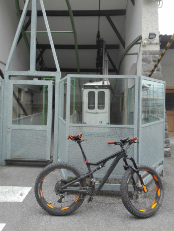
In the first lap you arrive via trails and secondary road to the Tschaufen farm, from here nice long descent to Terlan, with technical sections and return to the cable car. In the second lap you return to the Tschaufen, then climb again to the beautiful meadows of Jenesien with beautiful views. From here very long, varied descent with very technical sections to Settequerce and back to the cable car. Very enjoyable and scenic itinerary.

Local weather
Tue 00:00

14 °C
Tue 12:00

17 °C
Wed 00:00

14 °C
Wed 12:00
15 °C
Thu 00:00
12 °C
Thu 12:00

14 °C

Graph
Nearest Routes
21,98 km
Km
+1 200 mt
Vertical meters
Route difficulty
Landscapes
2023/09/02
- Italy - Trentino-Alto Adige/Südtirol, BZ 
27,16 km
Km
+1 145 mt
Vertical meters
Route difficulty
Landscapes
2023/02/26
- Italy - Trentino-Alto Adige/Südtirol, BZ 17,24 km
Km
+630 mt
Vertical meters
Route difficulty
Landscapes
2023/05/25
- Italy - Trentino-Alto Adige/Südtirol, BZ 
31,85 km
Km
+1 829 mt
Vertical meters
Route difficulty
Landscapes
2023/04/10
- Italy - Trentino-Alto Adige/Südtirol, BZ 21,43 km
Km
+1 028 mt
Vertical meters
Route difficulty
Landscapes
24,42 km
Km
+510 mt
Vertical meters
Route difficulty
Landscapes
2025/05/27
- Italy - Trentino-Alto Adige/Südtirol, BZ 42,05 km
Km
+2 150 mt
Vertical meters
Route difficulty
Landscapes
33,43 km
Km
+1 900 mt
Vertical meters
Route difficulty
Landscapes
28,26 km
Km
+1 190 mt
Vertical meters
Route difficulty
Landscapes
32,06 km
Km
+1 368 mt
Vertical meters
Route difficulty
Landscapes