
 Italiano
 Deutsch
2024/08/25 22:32:19
Cima Muta e malga Spitzner in val d'Ultimo
Author

Place
Italy - Trentino-Alto Adige/Südtirol, BZ
Km
38,00 km
Elapsed time
04:52:18
Vertical meters
+2 200 mt (1148 - 2641)
Route difficulty
Landscapes
Last update
2024/08/26 09:10:43
Comments
Hotels
Description
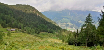
Very challenging route, rideable only by e-mtb due to extreme gradients, with fabulous views of the Ultimo valley and descents on very challenging but very fun trails.
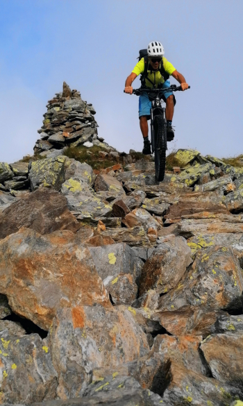
From the parking lot at the beginning of Lake Zoccolo we climb to the top of Mount Muta, above the ski lifts, at 2650 meters. From here very challenging descent on various trails to the lake.
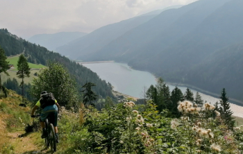
Round the lake and then, those who will still have strength, can climb to the Spitzner hut, with refreshments, where a beautiful trail starts, very challenging in the second part going back to the lake.
Local weather
Thu 00:00

16 °C
Thu 12:00

23 °C
Fri 00:00

18 °C
Fri 12:00
20 °C
Sat 00:00

14 °C
Sat 12:00
24 °C

Graph
Nearest Routes
51,12 km
Km
+2 300 mt
Vertical meters
Route difficulty
Landscapes
28,09 km
Km
+1 409 mt
Vertical meters
Route difficulty
Landscapes
22,36 km
Km
+1 200 mt
Vertical meters
Route difficulty
Landscapes
31,65 km
Km
+1 900 mt
Vertical meters
Route difficulty
Landscapes
2024/10/24
- Italy - Trentino-Alto Adige/Südtirol, BZ 34,79 km
Km
+1 300 mt
Vertical meters
Route difficulty
Landscapes
53,99 km
Km
+2 470 mt
Vertical meters
Route difficulty
Landscapes
2023/02/26
- Italy - Trentino-Alto Adige/Südtirol, BZ 26,94 km
Km
+1 020 mt
Vertical meters
Route difficulty
Landscapes
87,74 km
Km
+2 200 mt
Vertical meters
Route difficulty
Landscapes
2025/09/09
- Italy - Trentino-Alto Adige/Südtirol, TN 26,56 km
Km
+1 700 mt
Vertical meters
Route difficulty
Landscapes
41,08 km
Km
+1 500 mt
Vertical meters
Route difficulty
Landscapes