
 Italiano
 Deutsch
2025/11/15 18:14:48
Klapfberg val d'Ultimo
Author

Place
Italy - Trentino-Alto Adige/Südtirol, BZ
Km
51,12 km
Elapsed time
04:59:14
Vertical meters
+2 300 mt (1147 - 2088)
Route difficulty
Landscapes
Last update
2025/11/16 09:14:53
Comments
Hotels
Description
Itinerary that explores two little-known side valleys of Val d'Ultimo.
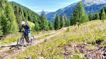
It starts from the lake of Zoccolo and climbs towards Santa Gertrude. You turn left and climb first to the Londai hut, then return on the same road to the fork (the more technical can descend on the trail) and climb right to the Klapfberg hut, with refreshments.
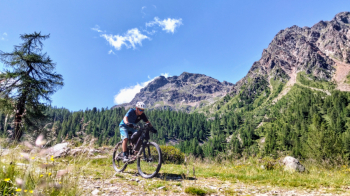
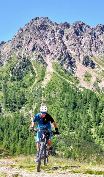
You descend back into Val d'Ultimo and it remains to do the last climb, which this time is very steep, ebike only. You arrive at the brizneralm, an alpine hut in Brez, without refreshment, with spectacular views.
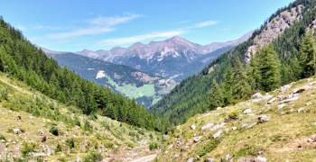
You descend back into the valley, go around the lake to return to the starting point
Local weather
Thu 00:00

16 °C
Thu 12:00

23 °C
Fri 00:00

18 °C
Fri 12:00
20 °C
Sat 00:00

14 °C
Sat 12:00
24 °C

Graph
Nearest Routes
2024/08/25
- Italy - Trentino-Alto Adige/Südtirol, BZ 38,00 km
Km
+2 200 mt
Vertical meters
Route difficulty
Landscapes
28,09 km
Km
+1 409 mt
Vertical meters
Route difficulty
Landscapes
22,36 km
Km
+1 200 mt
Vertical meters
Route difficulty
Landscapes
31,65 km
Km
+1 900 mt
Vertical meters
Route difficulty
Landscapes
2024/10/24
- Italy - Trentino-Alto Adige/Südtirol, BZ 34,79 km
Km
+1 300 mt
Vertical meters
Route difficulty
Landscapes
53,99 km
Km
+2 470 mt
Vertical meters
Route difficulty
Landscapes
2023/02/26
- Italy - Trentino-Alto Adige/Südtirol, BZ 26,94 km
Km
+1 020 mt
Vertical meters
Route difficulty
Landscapes
87,74 km
Km
+2 200 mt
Vertical meters
Route difficulty
Landscapes
2025/09/09
- Italy - Trentino-Alto Adige/Südtirol, TN 26,56 km
Km
+1 700 mt
Vertical meters
Route difficulty
Landscapes
41,08 km
Km
+1 500 mt
Vertical meters
Route difficulty
Landscapes