
 Italiano
 Deutsch
2023/01/30 21:40:10
Roen
Author
Place
Italy - Trentino-Alto Adige/Südtirol, BZ
Km
24,25 km
Elapsed time
05:34:26
Vertical meters
+1 389 mt (292 - 1569)
Route difficulty
Landscapes
Last update
2023/02/02 09:00:13
Comments
Hotels
Description
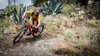
Itinerary for lovers of technical descents.
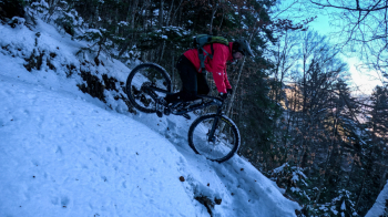
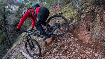
Once at the fork you can descend on the trail that continues on the other side, I went back just to enjoy the snowy descent. The last part of the ascent is by bike and the descent has many technical passages and an endless succession of hairpin bends.
Local weather
Gio 00:00

21 °C
Gio 12:00
28 °C
Ven 00:00

26 °C
Ven 12:00
26 °C
Sab 00:00

21 °C
Sab 12:00
28 °C
Graph
Nearest Routes
36,90 km
Km
+1 604 mt
Vertical meters
Route difficulty
Landscapes
34,31 km
Km
+1 100 mt
Vertical meters
Route difficulty
Landscapes
28,26 km
Km
+1 600 mt
Vertical meters
Route difficulty
Landscapes
19,93 km
Km
+1 100 mt
Vertical meters
Route difficulty
Landscapes
64,40 km
Km
+2 400 mt
Vertical meters
Route difficulty
Landscapes
30,38 km
Km
+1 600 mt
Vertical meters
Route difficulty
Landscapes
50,17 km
Km
+1 000 mt
Vertical meters
Route difficulty
Landscapes
17,43 km
Km
+751 mt
Vertical meters
Route difficulty
Landscapes
26,96 km
Km
+1 300 mt
Vertical meters
Route difficulty
Landscapes
59,06 km
Km
+2 100 mt
Vertical meters
Route difficulty
Landscapes