
 Italiano
 Deutsch
Presolana Ronda

An epic, spectacular ride—but don’t be fooled: even though the elevation gain isn’t record-breaking, the Presolana Ronda is a grueling tour that takes several hours and requires perfect pacing. You’ll be constantly in the presence of the limestone cliffs of the Queen of the Orobie, navigating terrain that puts both your physical endurance and technical skills to the test.
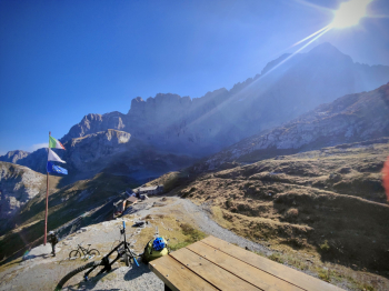
Ascent: From Colli to the Sentiero delle Capre
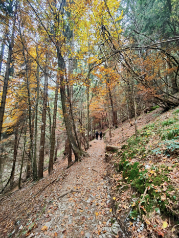
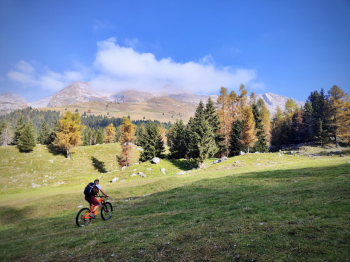
The route starts in Colere, with an asphalt climb featuring steep gradients right from the start up to the Presolana Pass. From here, the real challenge begins: the trail toward the Cassinelli Refuge is almost entirely rideable, but requires strong legs to avoid putting a foot down. The real turning point comes with the Sentiero delle Capre: on a standard MTB, prepare for a long push; on an e-MTB, with technique and power, you can dream of riding almost the entire way. The goal is the Olmo Refuge, the gateway to the first real adrenaline rush.
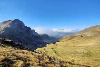
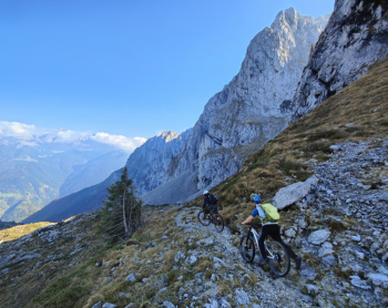
The Olmo Descent: Technique and Slowness
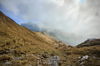
From the refuge begins a descent that is the essence of “slow and technical.” A consistent S4 grade with S5 sections where speed is zero and concentration is maximum. Every meter must be conquered with balance and pinpoint precision.
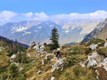
Lo Scagnello: The Route to Albani
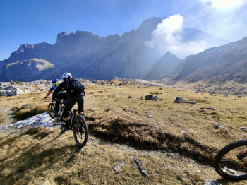
After a short connector, the route veers east onto a road with an extremely rough surface, a traction challenge where even EMTB motors struggle to keep riders in the saddle. Once the road ends, the trail toward Passo dello Scagnello becomes portage territory again for mechanical bikes, while e-bikes can still hold their own for most of the stretch. From the pass, the descent toward Rifugio Albani is short but intense: a concentration of S4 technical sections of rare aesthetic and technical beauty.
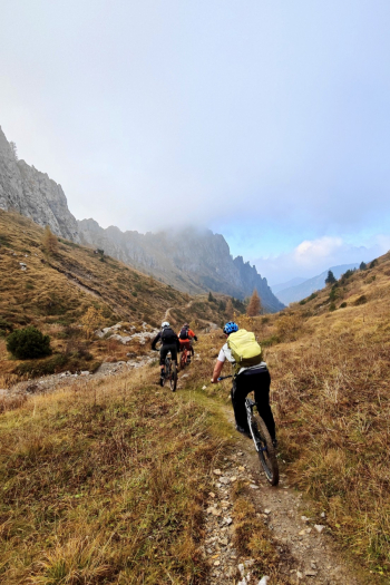
Final Hardline: The Sentiero della Guaita
From the Albani Refuge, the moment of choice arrives. The trail heads straight for the Sentiero della Guaita: a brutal S4+ that offers no respite, peppered with S5 sections requiring a perfect reading of the terrain. Note: absolutely avoid this section if wet; the rock is unforgiving. Alternative: If your energy is running low or you prefer something smoother, the S3 trail heading directly to Colere is the perfect alternative.
NOTES: If you want to avoid the asphalt climb from Colere to the Presolana Pass, you can drive up and then return to the trail.
Trail style: AM
Personal rating: Views 9/10; Descents 9/10 (for those who enjoy slow, technical riding)
Difficulty: Medium
MTB: Yes
EMTB: Yes, expect sections where you’ll need to walk
Duration: approx. 8h
Portage: Yes, especially on MTB
Climbing difficulty: generally very challenging
Downhill difficulty: S4/S5
Exposure: Sections with normal exposure
Drainage: Yes, in the first part; in the second part, wait until the rock is dry
Water sources: Olmo Hut, Albani Hut (check if open)


