Italiano
 Deutsch
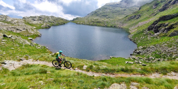
Passo del Gatto e i Laghetti del Venerocolo

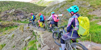
We take you to the magic of Val di Scalve where the Orobie Mountains will be the backdrop for a compelling tour done in pure All Mountain style. The descent will be all to experience with an unforgettable series and mix of compelling situations. But what will this descent sound like? You find out...
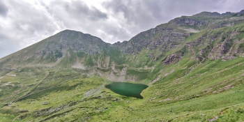
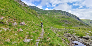
We are in Schilpario (BG) in the middle of Val di Scalve. We climb on asphalt toward the Vivione Pass without overdoing the pace because the good stuff will come soon. From the Pass we leave civilization for good, entering a real paradise, namely the Orobic Paradise. And that's just the beginning. On bumpy dirt mule track begins the second part of the ascent that alternates between pedaled and pushed stretches, but not on the shoulder. We pass the Baita del Pastore (Shepherd's Hut), Valbona Lake and arrive at the Passo del Gatto (Cat Pass). Let's say the most is done although I repeat the pedaling will be reduced. From the Pass we will now have a short technical descent that will become bumpy to the Laghetti di San Carlo. We will have one last uphill stretch before reaching the Venerocolo Pass where we can admire the Belviso Lake and then the Venerocolo Lakes. Very good: I suggest you now recover and get ready for one of the most beautiful descents in the area. The trail to follow will be No. 414, which alternates between Hard Rock and Rock n' Roll sections, smosso, roots, flow but also some hairpin bends where you can try your hand at it. Last meters on loose mule track in the Val del Vo and soon back to the cars. You will notice at the end of the descent that you will lack energy but at the same time you will have packed a first-rate Orobic tour.
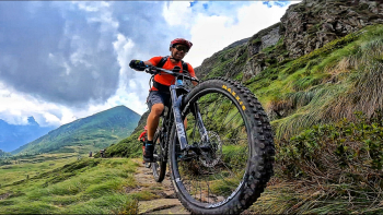
RECOMMENDED ROUTE FOR MOUNTAIN BIKE and/or E-BIKE ALL MOUNTAIN.
NB: At the time of inclusion this tour is all doable without any particular problems. We disclaim any responsibility for any inconvenience due to lack of maintenance of the trails or deterioration of the same due to external and/or natural agents and a wrong assessment of the tour.