HOME RANKINGS CHALLENGES ROUTES NEAR ME PLANNING SEARCH LOGIN
Italy - Lombardia, BG
2023/09/10 14:45:11

Rifugio Tagliaferri: variante Demigone

41 Downloads
3
 
Share

Key Takeaways / Scheda Tecnica

Disciplina:
Mountain Bike (MTB)
Percorso:
Rifugio Tagliaferri: variante Demigone
Località:
Italy - Lombardia, BG
Distanza:
41,09 km
Dislivello Positivo:
+2 027 mt (Quota Min: 1066m - Max: 2452m)
Difficoltà Tecnica:
5/5
Valutazione Panorami:
5/5
Formato Traccia:
GPX Download disponibile
Author
ValeBG
(181)
Place
Italy - Lombardia, BG
Km
41,09 km
Elapsed time
04:25:21
Vertical meters
+2 027 mt (1066 - 2452)
Route difficulty
Landscapes
Last update
2024/02/22 21:48:59
Comments
4
Description

Twin track of this track. but more recommended for mtb.

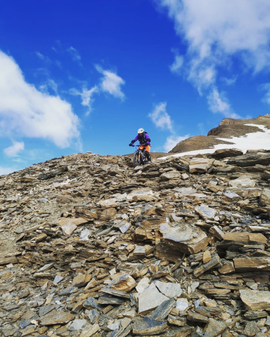
With this variation you reduce the ride by 150 meters of elevation gain and avoid the intermediate asphalt descent. Recommended especially for mtb's to avoid the 300 meters of killer ramps up to the Demigone malga, but it forces you to descend a scree slope, the choice is yours. From the Venerocolo pass instead of descending you climb 150 meters to the Demigone, and descend to the related hut. The Chamois Trail down to the Demignone hut has several sections on scree from a landslide. Not all doable in the first part then as you descend it gets better.
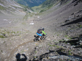
Foto itinerario MTB Rifugio Tagliaferri: variante Demigone - Italy - Lombardia, BG

With both of these trails you avoid the ridge trail which has become very inadvisable to do

Trail style: AM

Personal rating: views 10/10; descents 10/10

MTB: yes

EMTB: yes

Duration about 12h (by Mtb)

Pushing: yes many push and shoulder sections

Difficulty climbing: very challenging

Difficulty descent: medium S2/S3

Exposed: yes, very exposed sections (although not very long) during the climb to be done with bike in hand

Draining: I think so

Download our free mobile app to send this route to your Garmin device or to navigate it on OSM maps. Android - iOS
Local weather
Tue 00:00
10 °C
Tue 12:00
11 °C
Wed 00:00
11 °C
Wed 12:00
11 °C
Thu 00:00
9 °C
Thu 12:00
11 °C
Fri 00:00
6 °C
Fri 12:00
9 °C
Sat 00:00
6 °C
Sat 12:00
8 °C

Graph

Nearest Routes

2023/08/16
- Italy - Lombardia, BG
ValeBG
(181)
43,15 km
Km
+2 300 mt
Vertical meters
Route difficulty
Landscapes
2023/09/27
- Italy - Lombardia, BG
Giulien
(110)
31,44 km
Km
+1 501 mt
Vertical meters
Route difficulty
Landscapes
2024/09/23
- Italy - Lombardia, BG
alberico
(2)
27,17 km
Km
+1 700 mt
Vertical meters
Route difficulty
Landscapes
2025/08/18
- Italy - Lombardia, BG
ValeBG
(181)
37,23 km
Km
+1 750 mt
Vertical meters
Route difficulty
Landscapes
2024/07/15
- Italy - Lombardia, BG
giannig
(36)
27,26 km
Km
+1 750 mt
Vertical meters
Route difficulty
Landscapes
2025/09/10
- Italy - Lombardia, BG
giannig
(36)
27,23 km
Km
+1 800 mt
Vertical meters
Route difficulty
Landscapes
2025/11/01
- Italy - Lombardia, BG
ValeBG
(181)
27,69 km
Km
+1 700 mt
Vertical meters
Route difficulty
Landscapes
2026/08/24
- Italy - Lombardia, BS
9,67 km
Km
+540 mt
Vertical meters
Route difficulty
Landscapes
2024/07/14
- Italy - Lombardia, BS
ValeBG
(181)
27,75 km
Km
+2 150 mt
Vertical meters
Route difficulty
Landscapes
2023/06/17
- Italy - Lombardia, BS
Maxone1
(10)
19,77 km
Km
+1 067 mt
Vertical meters
Route difficulty
Landscapes

4 Comments