
 Italiano
 Deutsch
Rifugio Tagliaferri Original

Welcome to one of the most iconic and grueling routes in the Orobie Alps. This isn’t a trail for everyone: it’s a full-on mountain biking adventure where time seems to have stood still. The big news is that the original trail crossing the passes to reach Tagliaferri is now “passable” again. I use quotation marks because the new detour around the landslide requires nerves of steel: only attempt it if you’re comfortable with exposure, if you’re familiar with chains, and, preferably, if there are two of you to pass the bikes at critical points. If you’re alone or on an EMTB, it’s better to opt for the Demignone or Belviso routes.
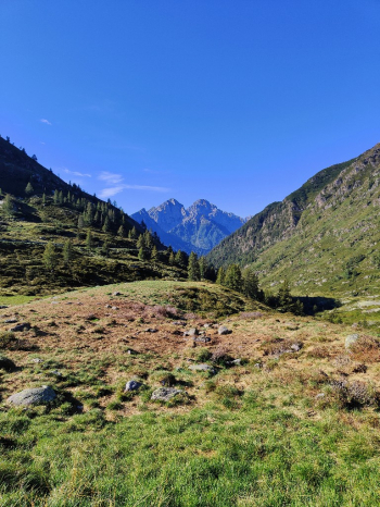
Ascent: from Vivione to Venerocolo
The route starts from Schilpario (note: in Ronco, parking is paid via the app). The first part is an easy climb on asphalt up to the Vivione Pass, which is good for warming up your legs. From here, the real climb to Passo del Gatto begins: currently, it’s a mix of pedaling and pushing, but ongoing construction (bulldozers are at work for 2025) will soon make it entirely rideable all the way to Passo del Venerocolo. This means an easier climb, but unfortunately the loss of the historic technical descent from Gatto.
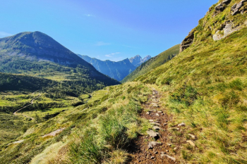
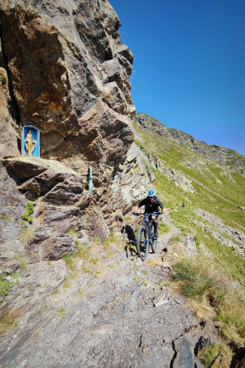
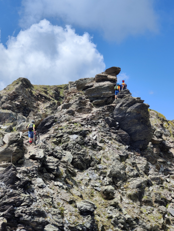
The Pass Crossing: Between Mountain Ranges and Scenic Bridges
After an initial descent from Passo del Gatto (not too narrow but with exposed sections), we climb back up to Venerocolo to begin the traverse toward Tagliaferri. Here we enter the realm of adrenaline:
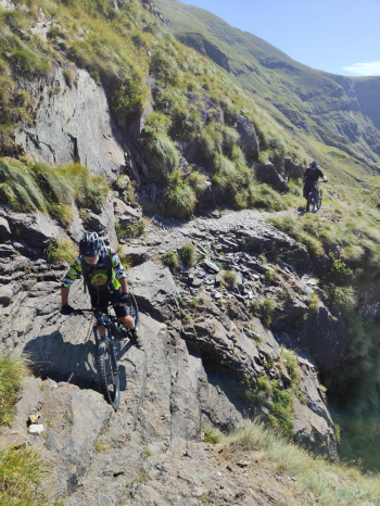
- Passo Demignone: A climb with sections assisted by chains.
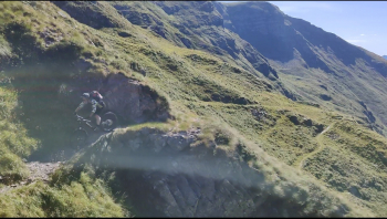
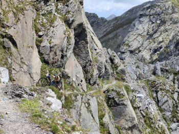
- Il Traverso: A long natural ledge that invites you to ride, butthe exposure is extremely high: there is no room for error here.
- The Frana Variant: Upon reaching the landslide junction, you face the most critical point where passing your bike is almost mandatory. Once past the obstacle, a more relaxed S2 section follows.
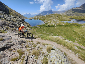
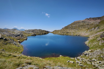
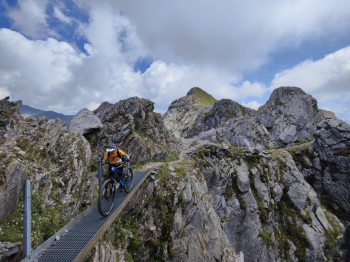
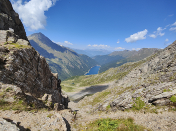
- Passo del Vo: Before reaching the refuge, Passo del Vo offers a breathtaking view of Lake Belviso.
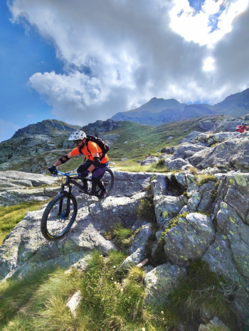
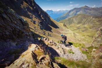
Descent: 10 km of Pure Ecstasy (1,200 meters of elevation drop)
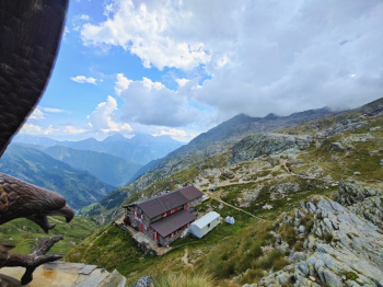
After a plate of pasta at the Tagliaferri Mountain Hut (2328m), you’ll get ready for one of the most famous and longest descents in the Bergamo area.
- The Start: The first 100 meters are “rough,” with sections requiring hand-over-hand climbing and chains.
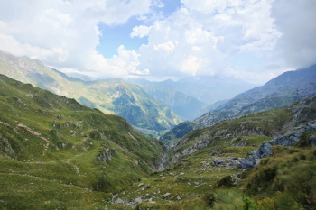
- The Heart: Once the last headache is over, the magic begins. 10 km of descent through wild mountain terrain. You’ll find it all: technical sections, flow sections, natural rock gardens, and trial-style passages.
- The Finale: As you lose elevation, the trail becomes faster and smoother, ending on a high note with a mix of rocks and roots that will take you back to Schilpario.
You’ll arrive in the valley dead tired after an endless day, but with the knowledge that you’ve completed one of the most epic rides in the entire Alpine range.
Trail style: All-mountain
Personal rating: Views 10/10; Descents 10/10
MTB: Yes
EMTB: Not recommended
Duration: approx. 11h (on MTB)
Portage: Extensive
Ascent difficulty: Easy up to Vivione, then very challenging
Descent difficulty: Moderate S3/S2
Exposure: High
Exhausting: YES
Water sources: See description


