
 Italiano
 Deutsch
Sant‘Amate alternativo

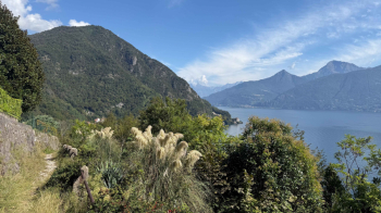
Sant'Amate is a classic Lake Como route, with fantastic views but a descent that usually does not fully repay the long climb. This alternative allows you to enjoy varied downhill trails all the way to the end of the tour. The start is in Cardano, which is part of Grandola ed Uniti, above Menaggio. There are many parking lots; the one where the trail begins is in front of a nice fountain. We descend toward the lake on mule tracks and several paths until we reach the banks of the Lario.
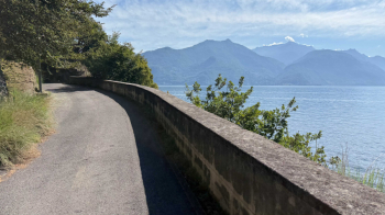
Here you continue on the old road, now used as a bicycle path, which intersects the state highway every so often when it comes out of the tunnels. The last piece, before Sant'Anna, is done on the state highway.
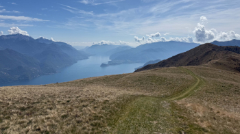
From Sant'Anna begins the long climb that will take us up to the small church of Sant'Amate. It is 1470 meters of elevation gain, at first rather gentle as you pass through the many villages high above the lake, then steeper as you climb into the woods. There is at least one fountain on the route. At one point the road becomes dirt and rather rough, but we are already in the pastures and there is about 300 meters of elevation gain to the highest point. The views become more and more beautiful.
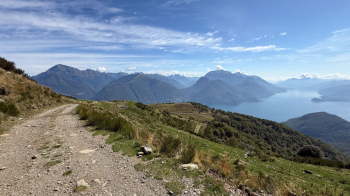
At one point we turn left and immediately arrive at Sant'Amate.
The small church of Sant'Amate, where our descent begins.
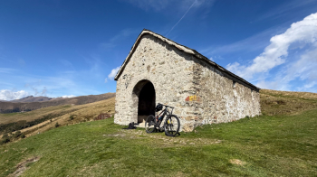
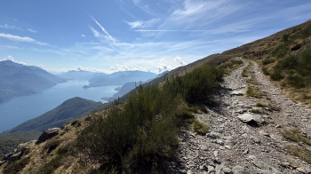
This descent has been put right recently, in the sense that dirt and stones have been put back on the path after it had been weathered. There are some technical steps at the beginning, but nothing impossible (S2/S3).
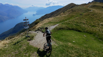
Then the trail becomes a spectacle, with views of the lake.
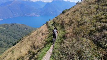
The long traverse is all to enjoy, impossible not to stop and look at the view.
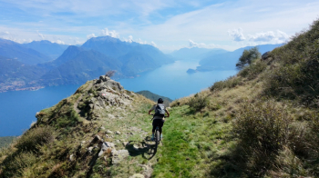
After the point in the photo above, the trail begins to descend more decidedly but, as mentioned before, it is much easier than in the past as it has been settled.
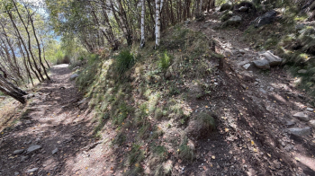
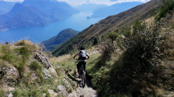
I met a fair number of pedestrians, mostly foreigners, confirming that Lake Como has now become an international tourist attraction. Then I also realized why: there is a parking lot not far from this photo. Continue intersecting the road to the Breglia Mountains and then to Breglia, a small village with very characteristic narrow streets. From here on don't lose track, because we will pass through trails that are poorly marked or not marked at all. Before Molino Spinzi we pass through a trail that takes us to a very fresh water spring: Chiarella.
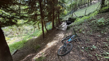
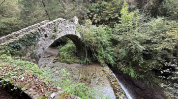
From Molino Spinzi we ascend 120 meters of elevation gain, then descend to Barna on unmarked trails. Beware if there is leaf, without GPS you will not find them. I then made the mistake of going down to Tobi, crossing the creek on a nice stone bridge.
The problem is that to go back up the other side you have to push your bike for 5 minutes, when really it would have been enough to just follow the path you took on the way down to get back to the parking lot.


