
 Italiano
 Deutsch
Monte Collecchio (Gleck) dalla Val d'Ultimo

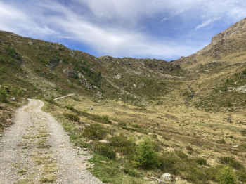
We start in Santa Gertrude in Val d'Ultimo (1400 meters) and immediately get onto trail 108, following the forest road that leads to the Rabbi Pass. The first 6-7 kilometers flow by quietly, the road is wide and quite rideable, the pace remains smooth and you are already enjoying the scenery. But then things change: the climb gets tough, the gradients increase and staying in the saddle becomes tiring, unless you have legs of steel or an e-bike to help you out.
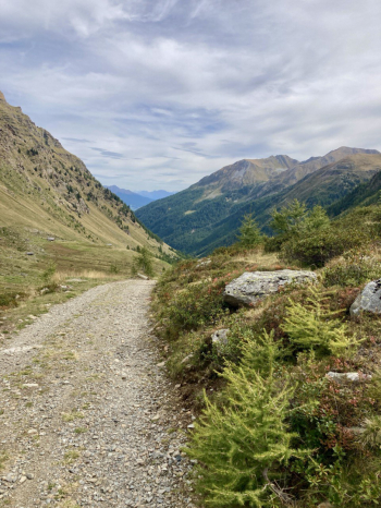
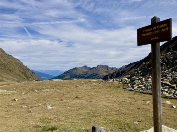
At the Bärhapp hut, the forest road ends and gives way to the trail: here the music changes again. Pedaling uphill is the stuff of those who really have legs and technique, otherwise you have to push a bit. The trail alternates between tough sections and smoother, more enjoyable bits, a continuous up and down that leads up to the Rabbi Pass, elevation 2449 meters, with increasingly wide views that repay the effort.
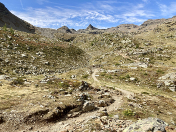
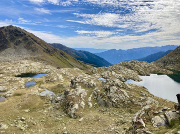
From the pass we rise for a moment more with a short climb, then finally the descent begins, leading straight to the Stella Alpina refuge at Lake Corvo: a mandatory stop to catch your breath and enjoy the place. From there we start west again, aiming for the Collecchio (Gelck) peak. The trail is very well marked, but in the saddle you don't go any more: the section begins with a shoulder or push bike, about 500 meters of elevation gain to push or carry your bike. The fatigue goes almost unnoticed, however, because you are walking in an incredible environment, among a constellation of small alpine lakes, with marmots whistling and eagles circling high overhead.
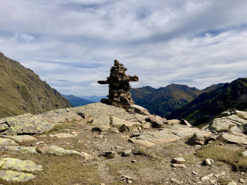
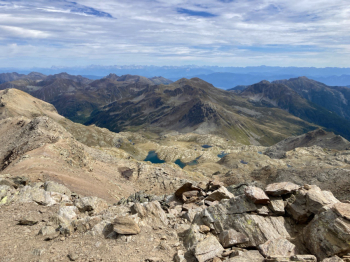
When you reach the top of Collecchio (2957 meters), all fatigue disappears in an instant: a breathtaking panorama opens up before you, a true spectacle worth every meter of ascent.

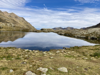
After a well-deserved break, you start north again, aiming for Giogo Nero. Here the path becomes cyclable again, except for a few short, more technical sections. You turn right, following the signs for Santa Gertrude: the first few meters are the classic steep alpine trail, with tight and challenging switchbacks (need to master the nosepress), but after the start the trail becomes more regular. In the heart of the valley the trail stays at high altitude, well-marked, passing by several alpine lakes to Fishermen's Lake. From here you continue to Santa Gertrude: at the alpine hut you take the forest road, because the trails are no longer bikeable. After a fork, you descend to the right, until you meet a path that is treacherous because of fixed stones in the ground. When you reach the valley, continue right toward the center until you reach the paved road and close the loop.
A challenging cycle-mountaineering tour, especially for the section to be done with the bike on your back. The descents are not trivial, but neither are they impossible: you need good bike control and some trialist technique for the more difficult passages. Recommended for experienced cyclists, best off-season and during the week to avoid crowds of hikers.


