
 Italiano
 Deutsch
Ãbnimatt, Binntal

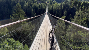
This is a loop that initially follows that of the Saflischpass, but then turns left in the direction of Binn. So we start at the Eggnishorn campground in Fiesch, ride for about 10 minutes on the busy cantonal road uphill and leave it to cross (push) the Thai bridge to get to the other side of the valley.
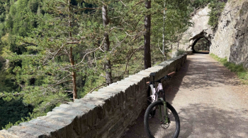
We transit through Ernen, one of the most beautiful villages in Switzerland, and continue falsely uphill toward Binn, with very little traffic. At the mouth of a long tunnel we keep to the right and follow the old, now unpaved, restored road.
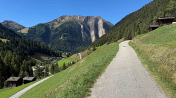
Back on the paved road, shortly afterwards we keep left and pass through the center of Binn, another of those Swiss villages that look like something out of a postcard. We leave Binn and immediately after the village turn left for what will be our ascent to the highest point of the tour. First an idyllic little paved road ...
... which soon after turns into a forest road that is never steep and pleasant to ride, with a scent of conifers that you can't help but like. Beautiful views, too.
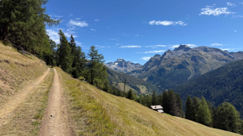
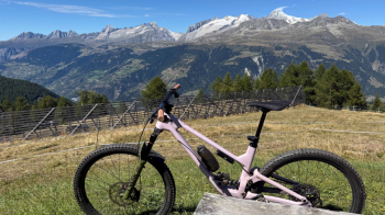
At an altitude of 2100 we leave the forest, change slopes and descend on a cart track to Ãbnimatt, that is, some alpine huts with pastures. The break with a panorama is a must.
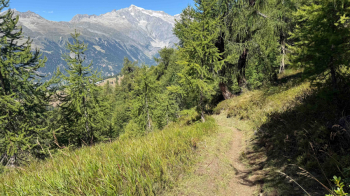
The descent begins immediately, and what a descent! A very flowing singletrack, on a forest floor, with many curves that are never too tight.
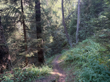
After finishing this stretch, which is rather long, a traverse with several up and downs awaits us, one of which we will have to push the bike to cross a stream and climb back up. Several roots make the trail quite technical in some places (S3 passages), otherwise it can be pedaled well.
We thus come out on a forest road, which we follow losing little elevation gain. It leads us to a paved road, which we follow uphill for 100 meters of elevation gain, and then take the final descent to Engen: it is called Kapellenweg, is rather steep but wide and presents no major difficulties. In Engen we follow the outward route, crossing the Tibetan bridge, to return to Fiesch.


