Italiano
 Deutsch
Rifugio Maria e Franco Alta via dell'Adamello

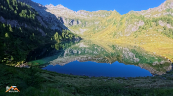
A beautiful mountaineering cycle on the 4th stage of the famous Alta via dell'Adamello. We start from pay parking (7 Euro daily fee) just above the Malga Bissina barrage at the end of Val Daone and the beginning of Val di Fumo at 1780 meters in western Trentino. Parked in the wide esplanade at the far left end, Trail 442 begins, which shortly raises us to beautiful Lago di Campo with slopes that are never too bad except for short stretches. Reaching the lake, if at the right hours, we find it in mirror mode where it amplifies the beauty of the surroundings. We cross the lake esplanade with the ruins of an old alpine hut and proceed on a nice, steep bike trail until the end of the arboreal vegetation, then the Alpine prairie begins and the climb becomes pleasant to the Campo pass. We have now intercepted the Alta via dell'Adamello and the opening landscape becomes embellished with beautiful peaks.
To the right we proceed to Passo Ignaga (the first hypothesis then shelved as the now faded memory of the place did not return me positive feelings relatively to the descent by bike). We then proceed left toward the Maria and Franco refuge. We are on the Alta via dell'Adamello, trail No. 1.
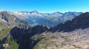
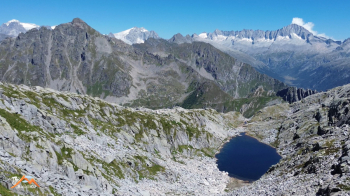
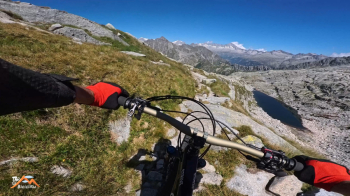
The Sega d'Arno and Monte Re di Castello observe us for a long stretch as we cross the immense stony ground (watch out for the one fork that, although well marked, I skipped and paid for it in terms of fatigue) only to hide when we ascend the right bank of the tiny Lake Dernal and the pass of the same name. We are at the Maria and Franco, former Brescia refuge, a refreshment and prepare for the descent. We push up a few meters and from the Dernal pass the view of Carè Alto and the Adamelline peaks is sumptuous, moving.
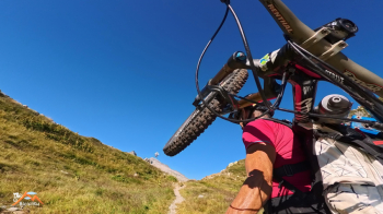
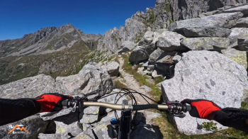
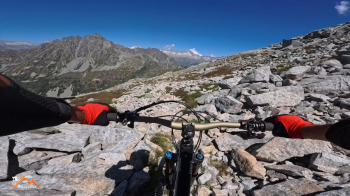
The descent begins, obviously some pebbles are not missing (understatement) but the gradient never worries so we let ourselves cycle with physical fatigue but great satisfaction. Just before Passo di Campo, a short stretch with bike on the shoulder and the trail becomes even easier and allows us to admire the beautiful and colorful Lago D'Arno. We descend the meadowy east side of the pass with fun to the scree just above the lake, here bike alongside and descend 150 meters of elevation gain to the prairie above the lake. One more short ascent and then off on the trail back to the car, which except for two short passages is biked with fun.
Short but intense trip in all, but really all aspects.