HOME RANKINGS CHALLENGES ROUTES NEAR ME PLANNING SEARCH LOGIN
Italy - Lombardia, BS
2025/11/05 08:19:58

Monte Misa e passo Croce Dominii

57 Downloads
1
 
Share
Author
biciclitu
(30)
Place
Italy - Lombardia, BS
Km
29,15 km
Elapsed time
08:54:48
Vertical meters
+1 450 mt (1491 - 2177)
Route difficulty
Landscapes
Last update
2025/11/05 09:12:27
Comments
0
Description

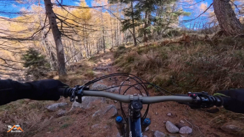
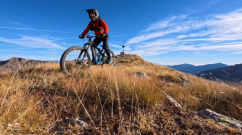
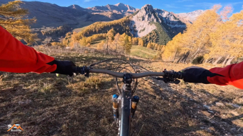
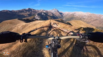
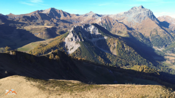
This fun mtb excursion starts from the Gaver locality above the beautiful town of Bagolino (BS). We climb on asphalt the Spbs669 via Goletto di Gaver to the Croce Dominii pass. We now proceed on Spbs345 to the Vaia Alp. We have covered about 15 km and 600 meters of elevation gain. Now in undulating progress we proceed on cemented forestry and partly trail until we reach the beautiful Malga Rondenino di Cima. We descend the wet and very fun trail 431 that connects Rondenino di Cima with Malga Rondenino Basso. We now ascend on 424 to Goletto di Cadino, passing again by the Passo Croce Dominii hut. We descend on asphalt the short and beautiful transfer descent to Goletto di Gaver. We now keep to the right on an uphill dirt road that shortly takes us to the entrance of 429, a beautiful trail widened in the first part during the restoration of the Casinello della Misa until we reach the summit of Mount Misa, a renowned ski mountaineering route. There are two crosses on the summit; we visit both. From Goletto we climbed 400 meters of elevation gain.

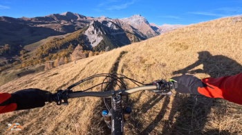
Now we descend with much, much fun the panoramic Misa meadows, never too difficult until we reach the Gaver Goletto again and from there on the meadowy snowshoe trail that cuts three times down to the start, the Blumon Break parking lot on the Gaver plain.

Download our free mobile app to send this route to your Garmin device or to navigate it on OSM maps. Android - iOS
Local weather
Gio 00:00
9 °C
Gio 12:00
15 °C
Ven 00:00
10 °C
Ven 12:00
13 °C
Sab 00:00
9 °C
Sab 12:00
12 °C
Dom 00:00
10 °C
Dom 12:00
17 °C
Lun 00:00
12 °C
Lun 12:00
17 °C

Graph

Nearest Routes

2025/07/02
- Italy - Lombardia, BS
biciclitu
(30)
19,67 km
Km
+1 200 mt
Vertical meters
Route difficulty
Landscapes
20,86 km
Km
+1 020 mt
Vertical meters
Route difficulty
Landscapes
2025/07/22
- Italy - Lombardia, BS
giannig
(34)
20,94 km
Km
+1 600 mt
Vertical meters
Route difficulty
Landscapes
2022/10/09
- Italy - Lombardia, BS
Giulien
(110)
28,09 km
Km
+1 348 mt
Vertical meters
Route difficulty
Landscapes
2024/07/20
- Italy - Lombardia, BS
Staff
(108)
24,25 km
Km
+1 200 mt
Vertical meters
Route difficulty
Landscapes
2023/10/19
- Italy - Lombardia, BS
Padagiant
(9)
24,25 km
Km
+1 300 mt
Vertical meters
Route difficulty
Landscapes
2022/12/25
- Italy - Lombardia, BS
27,71 km
Km
+1 329 mt
Vertical meters
Route difficulty
Landscapes
2023/07/16
- Italy - Lombardia, BS
richin
(5)
30,08 km
Km
+1 407 mt
Vertical meters
Route difficulty
Landscapes
2023/07/04
- Italy - Lombardia, BS
Padagiant
(9)
19,99 km
Km
+900 mt
Vertical meters
Route difficulty
Landscapes
33,19 km
Km
+2 100 mt
Vertical meters
Route difficulty
Landscapes

0 Comments