
 Italiano
 Deutsch
Anello lago di Como, Valle Albano, Val Cavargna per Cima Verta

The ascent to Giovo and S. Jorio is a classic route that can be done by following different roads; this time I did an unusual one, climbing from Consiglio di Rumo I took the road to Brenzio, continuing on to the Maiavacca bridge. At an elevation of 670 meters, just before a small chapel, go up to the left on a dirt road, partly cemented, that reaches Nassa, where it joins the road, part asphalt and part dirt, that passes the Basciarino Alp and the Mottafoiada refuge, shortly after which you arrive on the last section of the road that goes up from Dongo to Giovo at 1700 meters.
From Giovo you continue on the former military road that goes through Alpe Albano, with a bit of up and down to the Sommafiume refuge: fairly wide dirt road, only in a few places exposed and with landslide stones here and there (and in this period well full of bushwhackers).
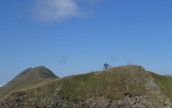
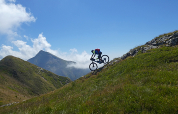
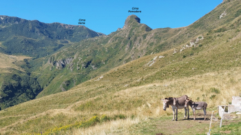
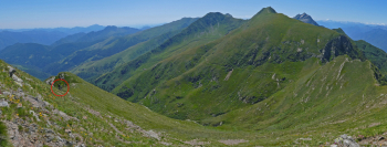
One does not cross the Albano stream to get to the refuge, but zigzags up the left side of the valley from an altitude of 1760 via Bocchetta di Sommafiume to the 2078 meters of Cima Verta, the junction point between the Albano Valley and the Cavargna Valley, with the Morobbia Valley on the Swiss side. These approximately 300 meters of elevation gain are almost all done by pushing or shouldering with regular mtb, while with e-mtb they can be done 60/70% pedaled, BUT ONLY FOR EXPERT MTB CYCLISTS, NOT BEGINNERS WITH E-MTB! Exposed sections, lots of loose boulders, steep and sunken trail, hollowed out switchbacks. The 360° view from the summit is spectacular, with Pizzo di Gino not far to the southwest.
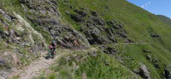
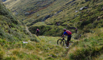
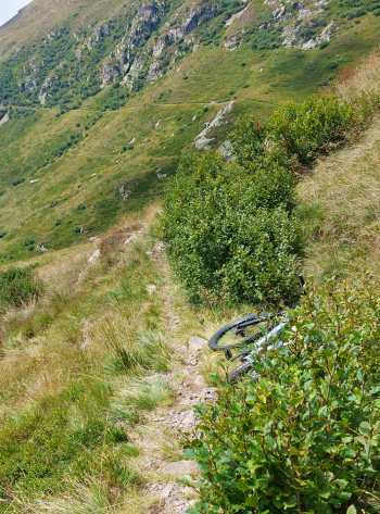
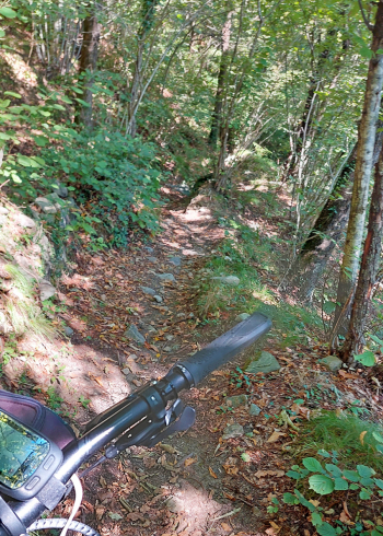
The first part of the descent is very challenging on a narrow trail, with loose boulders, exposed in places and encroaching hornbeam bushes, to the Tappa vent, about 150 elevation gain further down: for experts only, not e-bike beginners. From here on it becomes wider but at times with very hollow sections, to Stabiello Alp, at an elevation of 1702 meters. Continue to in the Vegna mountains passing a challenging S in a small valley and then crossing the bridge over the Vallone stream at elevation 1400. From the mountains of Vegna (1300 meters) you descend by asphalt road to Cavargna at an altitude of 1000 meters, then ascend to the Cava pass, 1150 meters, and descend into Val Rezzo. At the first hairpin bend in Buggiolo, exit left and take the Majesty road, which is initially unpaved, then becomes a nice smooth path through the woods. By back roads and mule tracks to Corrido, then Carlazzo and Gottro, where you take another nice path to Velzo. At Codogna descend to the Chioderia mill, then by small roads and paths to Loveno and on to the lake at Nobiallo, a hamlet of Menaggio. Return to Domaso following the bike path, with some variation between Acquaseria and Rezzonico, just to enjoy a bit of climbing and mule tracks.
In total it is 88 km and 2700 m of positive elevation gain.
NOTE : if some entity were to take the trouble to fix the section between Giovo and the Vegna mountains, this would certainly become an epic route in the mountains of the Alto Lario.
IMPORTANT NOTE : It can be done by e-mtb, but only with good previous mountain biking experience, not if you started with ebikes and do not have good bicitrial experience.
