HOME RANKINGS CHALLENGES ROUTES NEAR ME PLANNING SEARCH LOGIN
Italy - Lombardia, LC
2025/08/03 16:14:25

Anello del Monte Legnone

92 Downloads
1
 
Share

Key Takeaways / Scheda Tecnica

Disciplina:
Mountain Bike (MTB)
Percorso:
Anello del Monte Legnone
Località:
Italy - Lombardia, LC
Distanza:
59,70 km
Dislivello Positivo:
+2 536 mt (Quota Min: 202m - Max: 2569m)
Difficoltà Tecnica:
5/5
Valutazione Panorami:
5/5
Formato Traccia:
GPX Download disponibile
Author
DaniCana
(1)
Place
Italy - Lombardia, LC
Km
59,70 km
Elapsed time
06:05:30
Vertical meters
+2 536 mt (202 - 2569)
Route difficulty
Landscapes
Last update
2025/09/21 09:24:01
Comments
13
Description

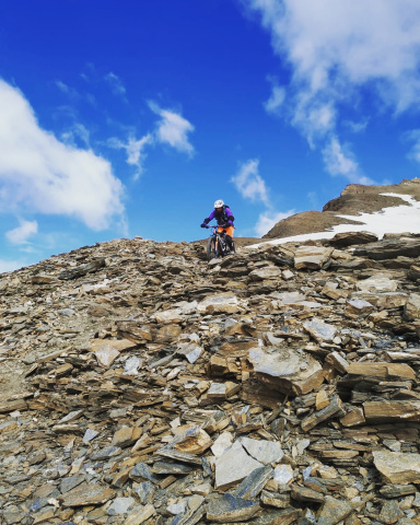
Departure from Colico in the direction of Dervio. From here a gentle asphalt ascent, up to an altitude of about 900 meters, brings us to cross on the left the driveway that goes up to Alpe Griera (1750 meters). From here the driveway becomes a nice path with slopes that are never bad but very long, seemingly endless. We arrive at a fork where we completely change direction and a clearly visible traverse takes us to the locality "gallerie" (2400 meters). From here begins the fairly technical shoulder section to the top,where you can enjoy a spectacular panorama to say the least.

We descend again to the "galleries",being very careful and in the direction of Val Lesina we take a tough and exposed descent that leads us to the Legnone refuge (well marked). From here we enter the woods on a fun but non-trivial single track to Osiccio. We are almost there. Now you can opt for a simple roadway or for sloping mule tracks that project us directly to Delebio at starting altitude. A few kilometers and we are back in Colico.

Great satisfaction, but lots of fatigue and care to bring the necessary food and hydration (zero water after the Griera) and any tire repairs. #lagodicomo

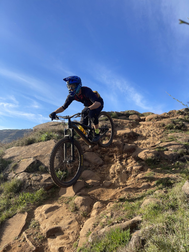
Foto itinerario MTB Anello del Monte Legnone - Italy - Lombardia, LC

Foto itinerario MTB Anello del Monte Legnone - Italy - Lombardia, LC

Foto itinerario MTB Anello del Monte Legnone - Italy - Lombardia, LC

Foto itinerario MTB Anello del Monte Legnone - Italy - Lombardia, LC

Download our free mobile app to send this route to your Garmin device or to navigate it on OSM maps. Android - iOS
Local weather
Mar 00:00
14 °C
Mar 12:00
16 °C
Mer 00:00
14 °C
Mer 12:00
16 °C
Gio 00:00
13 °C
Gio 12:00
16 °C
Ven 00:00
12 °C
Ven 12:00
13 °C
Sab 00:00
10 °C
Sab 12:00
16 °C

Graph

Nearest Routes

2022/10/20
- Italy - Lombardia, LC
marco
(195)
54,49 km
Km
+2 439 mt
Vertical meters
Route difficulty
Landscapes
2023/05/09
- Italy - Lombardia, SO
marco
(195)
25,10 km
Km
+1 590 mt
Vertical meters
Route difficulty
Landscapes
2022/08/05
- Italy - Lombardia, CO
43,50 km
Km
+1 651 mt
Vertical meters
Route difficulty
Landscapes
2025/07/31
- Italy - Lombardia, LC
giannig
(36)
57,10 km
Km
+2 780 mt
Vertical meters
Route difficulty
Landscapes
2023/03/15
- Italy - Lombardia, SO
21,91 km
Km
+1 603 mt
Vertical meters
Route difficulty
Landscapes
2023/10/18
- Italy - Lombardia, CO
AlfreDoss
(6)
27,78 km
Km
+1 540 mt
Vertical meters
Route difficulty
Landscapes
2025/07/21
- Italy - Lombardia, CO
pedalario
(7)
39,72 km
Km
+1 400 mt
Vertical meters
Route difficulty
Landscapes
2026/01/21
- Italy - Lombardia, CO
pedalario
(7)
29,09 km
Km
+1 750 mt
Vertical meters
Route difficulty
Landscapes
79,20 km
Km
+2 700 mt
Vertical meters
Route difficulty
Landscapes
2025/07/19
- Italy - Lombardia, CO
pedalario
(7)
61,46 km
Km
+2 367 mt
Vertical meters
Route difficulty
Landscapes

13 Comments