Italiano
 Deutsch
Monte Legnone

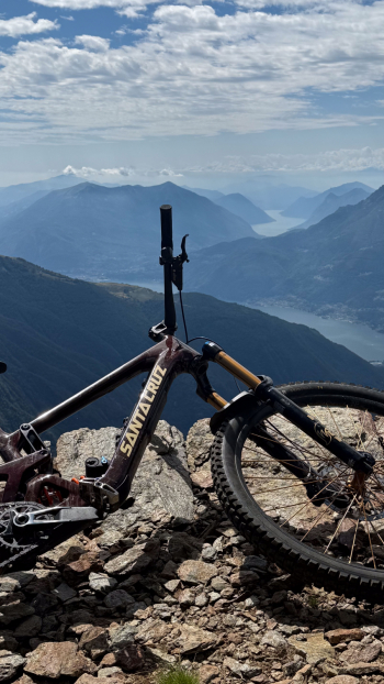
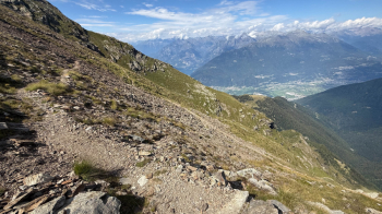
The mother of all #lagodicomo itineraries, with an ascent of no less than 2200 meters of elevation gain, the last 800 of which are on a spectacular trail that is all pedalable! Mount Legnone is the highest peak of all the Pre-Alps. It overlooks the far northern end of Lake Como. From the summit, on the clearest days, you can see from west to east, the Ligurian Alps, Monviso, Mont Blanc, Monte Rosa, the Matterhorn, the Oberland, the giants of the Rhaetian Alps, the Orobie Mountains to the Dolomites. Toward the south the Po Valley, the Apennines and, on windy and clear days, even Milan.
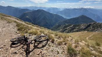
The Tour includes the circumnavigation of Mount Legnone, taking advantage for the most part of the mule tracks and military roads built in defense of the Po Valley in case of enemy entry from Valtellina or Switzerland (Cadorna Line). There is no ascent to the summit in this trail; it can be done by leaving the bike at the highest point of the trail and climbing on foot. The tour starts in Colico and runs for about 24 km on asphalt to the village of Gallino (Galin) at about 950 meters altitude in Valvarrone. Obviously this section can be avoided by resorting to the car, although then the problem of recovery remains.
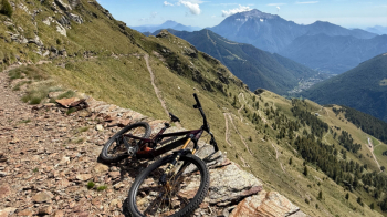
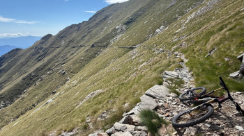
The dirt road from Galin is easily pedaled up to the highest point of the tour, as the path we take in the last 800 meters of elevation gain has been put in place and is one of the absolute most beautiful climbs to make by MTB. The summit (2609 meters), as mentioned above, can only be reached on foot from the mtb high point (about 2400 meters).
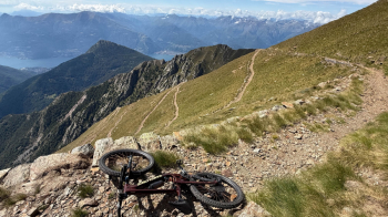
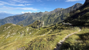
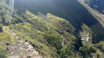
On the descent from 2400 to about 2100, the road has collapsed in several parts and has become a path, with very closed hairpins and a bumpy bottom, be careful because it is also largely exposed. From time to time the trail is fixed. The tour includes an ascent to Colombano Pass (2005 meters), for about 200 meters of elevation gain, and a descent to Rifugio Scoggione, still on a partly landslide military road.
From Rifugio Scoggione (1575 meters), property of the CAI of Colico, usually run in the summer wetiv,) to about 1200 elevation (Prà dei Formica), is the most challenging piece, being a path that descends into a larch forest, with several stony steps, then everything becomes easier as you enter a beautiful beech forest, until you come out in Rusico (about 800 meters).
Here you have two options, either continue to follow the track on now disused and therefore quite challenging trails, or descend to Colico along the cemented road that then becomes paved, until you cross the descent track again.
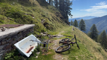
Pictured below is the last water point on the ascent, at an elevation of 1660 meters.
Update summer 2025
Ascent: all completely rideable. Beautiful and very long! Eventually you can lean at Rifugio Griera to do the tour in 2 days.
Descent: there are small landslides that do not allow to ride all the way down on the military road. Some nice "flowing" sections, others to overcome with bike in tow.
Hairpin bends going up to Colombano Pass are in order. From Alpe Scoggione to Pian di Formica many passages are done on foot, on the other hand from Pian di Formica they have marked the trail very well and it is a pleasant descent.
Overall it is a "hate and love" route, there are sections that are terrible and the bike is in the way and sections where you enjoy like urchins going down into the woods. Overall it is a good butchery but gives so much satisfaction.