
 Italiano
 Deutsch
Alpe Giumello Monte Croce di Muggio

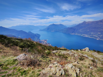
Monte Croce di Muggio offers an ottmo panorama; the ascent is mainly on asphalt with little traffic in the off-season. The descent could be very nice but it is dirty in places so it cannot be fully appreciated.
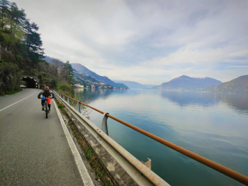
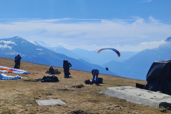
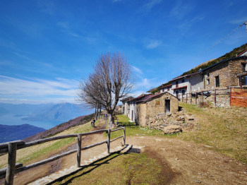
Start from Dervio and after traverse along the lake with beautiful morning panorama we reach Bellano. From here all asphalt with 6% gradient until Inesio where we take a nice trail that allows us to break and shorten the climb. The trail pedals well in emtb, but is challenging in mtb. Back on asphalt the penzence rises to 10% and in a short time we reach Alpe Giumello. We pass by the paraglider launching area and then push the bike about 200 meters up prairie wide enough not to be uncomfortable to the Muggio cross. There are multiple water points during the ascent.
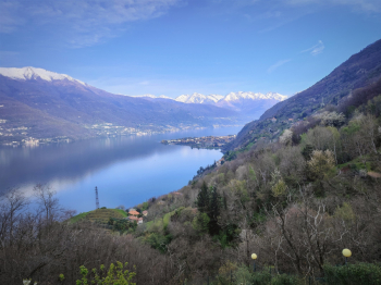
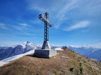
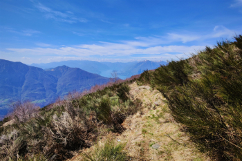
We admire the top view, and launch first on a not very technical descent and then deviate to the left from a nice alpine S2 trail with some nice steps S3. Arrived at the Alpe another water point and then down a beautiful S3 with S4 steps that unfortunately does not last long. From Monte Tedoldo we continue on a flat carrale to come out at another beautiful viewpoint (Camaggiore area). From here it is a succession of broken descents never too technical and sometimes dirty with leaves until we reach Vignago where the descent becomes a long (and boring) mule track of about 350 meters of elevation gain that will take us back to Dervio.
Trail style: AM
Personal rating: views 8/10; descents 7/10
MTB: yes
EMTB: yes
Duration about 5h (in Mtb)
Pushing sections: about 200m push to climb to the Cross
Difficulty ascent: only short, very challenging middle section, the rest runs smoothly
Difficulty descent: mainly S1/S2 with short section S3/S4
Exposed: no
Drainage: there are wet sections during the descent, but it seems quite draining.


