
 Italiano
 Deutsch
Monte Legnone, giro integrale
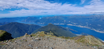
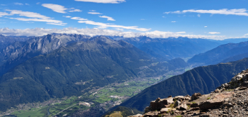
Stunning All Mountain loop tour, with ascent of the iconic peak by walking the last 200 meters, very long and challenging. The endless descent (2450 meters of elevation gain) is varied, has stretches of narrow and exposed trail to be taken with the utmost care and a nice section, below the Scoggione refuge very difficult, technical (S4). The isolated, strategically located summit is very scenic, uniquely beautiful.
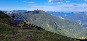
Doing it in the day is a Hapsburg effort, given the considerable elevation gain, development and difficulty but it is possible as well as convenient to break it into two stages, with a stop at the excellent Alpe Griera hut, 1700 meters (small, cozy and you eat a great meal).
Departing from Colico (free parking in Via alla Chiesa), walk south along the lake to Corenno Plinio (Dervio). here go up a section of the old medieval road to join the asphalt Valvarrone road, towards Premana. At Alpe Gallino you leave the asphalt to take the Monte Legnone military road. At an altitude of 1724 meters, after 20 hairpin bends, you reach the Alpe Griera hut.
After the refuge, the road becomes a very well maintained, scenic trail/muletrack that allows you to climb, with another 24 hairpin bends, pedaling up the very steep slope to the Matocc del Petòo saddle, 2299 meters.
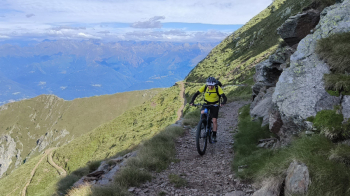
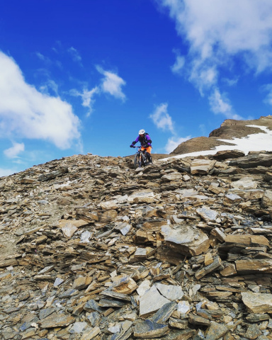
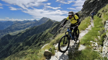
Now the music changes, the path narrows and becomes exposed and less rideable, with a long traverse you reach the so-called galleries, 2400 meters, where you leave your bikes.
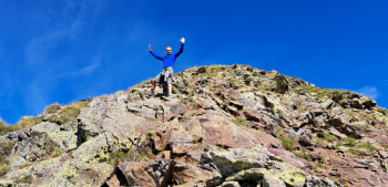
You walk the last 200 meters of rocky ridge (it is easy but you have to be careful).
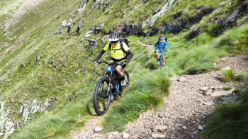
Returning along the same ridge to the bikes, putting on the protections, the descent begins. Along the first part there is a narrow path, not very well maintained that descends in hairpin bends, very exposed, difficulty S3/S4 for exposure.
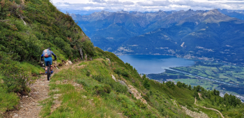
When you reach an altitude of 1850 meters, near the junction for the Legnone refuge, go up a few hairpin bends to a Colombano saddle at an altitude of 2000 meters. Now the descent becomes fairly easy, apart from a non-compulsory cut to the Scoggione refuge, 1700 meters. From just below the refuge, to Pian Formica, the technically more difficult section begins (S4), all in the woods, never exposed but you need to have a good and safe riding technique to get down on the pedals.
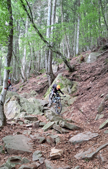
At Pian Formica the trail becomes less difficult (S2-S3) and the rest of the descent also flows without any particular problems passing by Alpe Prato, Rusico. When you reach the locality Fontanedo you descend briefly by cemented road, paying attention to a fork on the right, and still on cemented road you go up about thirty meters in altitude until you find a path on the left that leads to the last part of the descent to the car.
