

 Italiano
 Deutsch
2024/10/29 16:23:25
Da Merano alla Mairalm in val Senales
Author

Place
Italy - Trentino-Alto Adige/Südtirol, BZ
Km
52,33 km
Elapsed time
05:34:19
Vertical meters
+2 300 mt (298 - 2096)
Route difficulty
Landscapes
Last update
2024/10/29 19:22:04
Comments
Description
Very challenging route with long, sometimes steep climbs and technical downhill trails. Plus a few connecting trails with short pushing sections. At the top, at the Dickalm or Mairalm, refreshments.
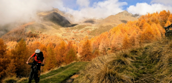
Caution, trail 10 to Naturno is off-limits to bikes, please do not pass on weekends and during tourist season.
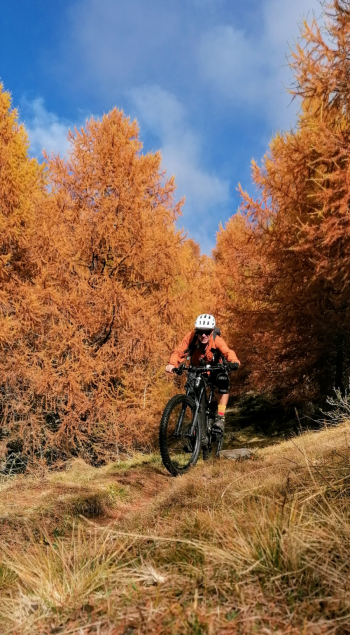
Possibly descend on trail 6 which is less frequented and just as beautiful.
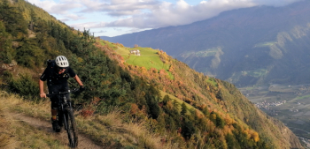
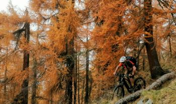
Very beautiful views of the Vinschgau and Schnals valley. If done in autumn beautiful autumn colors. The tour is very long if done from Merano, possibly you can start from Rablà or Plaus. Perfect to do by ebike
Local weather
Tue 00:00

15 °C
Tue 12:00

18 °C
Wed 00:00

15 °C
Wed 12:00
14 °C
Thu 00:00

13 °C
Thu 12:00

15 °C

Graph
Nearest Routes

86,52 km
Km
+3 200 mt
Vertical meters
Route difficulty
Landscapes
86,32 km
Km
+2 856 mt
Vertical meters
Route difficulty
Landscapes
64,24 km
Km
+2 500 mt
Vertical meters
Route difficulty
Landscapes
92,23 km
Km
+2 900 mt
Vertical meters
Route difficulty
Landscapes
36,78 km
Km
+1 610 mt
Vertical meters
Route difficulty
Landscapes
2025/11/21
- Italy - Trentino-Alto Adige/Südtirol, BZ 66,02 km
Km
+2 000 mt
Vertical meters
Route difficulty
Landscapes
67,38 km
Km
+1 900 mt
Vertical meters
Route difficulty
Landscapes
65,56 km
Km
+2 000 mt
Vertical meters
Route difficulty
Landscapes
2023/03/01
- Italy - Trentino-Alto Adige/Südtirol, BZ 49,83 km
Km
+950 mt
Vertical meters
Route difficulty
Landscapes
90,75 km
Km
+1 510 mt
Vertical meters
Route difficulty
Landscapes