HOME RANKINGS CHALLENGES ROUTES NEAR ME PLANNING SEARCH LOGIN
Italy - Trentino-Alto Adige/Südtirol, BZ
2024/08/06 10:43:27

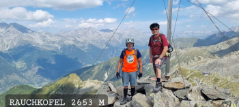
Rauchkofel Valle Aurina

2 Downloads
0
 
Share
Author
Place
Italy - Trentino-Alto Adige/Südtirol, BZ
Km
20,15 km
Elapsed time
00:00:00
Vertical meters
+1 700 mt (1017 - 2604)
Route difficulty
Landscapes
Last update
2024/08/06 16:39:15
Comments
0
Description

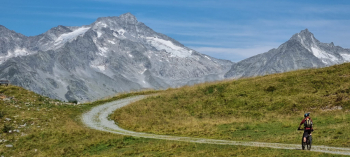
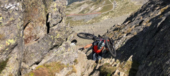
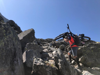
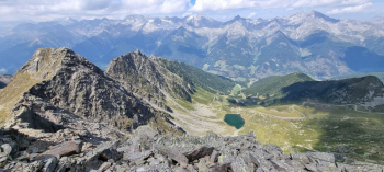
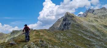
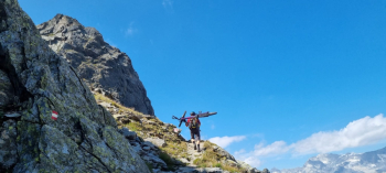
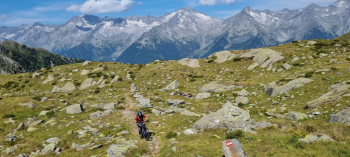
A beautiful and long traverse of pure cyclo-mountaineering only for those with good training, and pathophiles of the genre. About 900 meters of elevation gain with uphill bike and downhill sections where you have to push your bike.

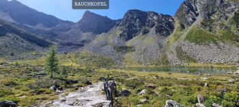
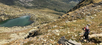
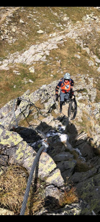
It starts from Cadipietra, if you want you can take off some of the elevation gain by taking the cable car. Pedaled uphill on steep cart track to Klaussee lake, bike on shoulders, climbing sections, small but challenging via ferrata. and non-bikeable downhill segments. First meters descent with short cyclable and very exposed passages. Passed the challenging ferrata, climb up in the saddle to the Creste Di Poja. Enter trail No. 6 with beautiful technical switchbacks and passages on very challenging granite slabs, technical flow sections, to the final vertical that catapults us directly into the hamlet of San Johann Valle Aurina.
Download our free mobile app to send this route to your Garmin device or to navigate it on OSM maps. Android - iOS
Local weather
Today
8 °C
Tonight
0 °C
Tomorrow
9 °C
Tomorrow night
-1 °C
Sunday
8 °C
Sunday night
-1 °C
Monday
7 °C
Monday night
-2 °C
Tuesday
5 °C
Tuesday night
-4 °C

Graph

Nearest Routes

2024/07/22
- Italy - Trentino-Alto Adige/Südtirol, BZ
nonnocarb
(292)
31,43 km
Km
+1 830 mt
Vertical meters
Route difficulty
Landscapes
2023/03/04
- Italy - Trentino-Alto Adige/Südtirol, BZ
giobike73
(49)
36,75 km
Km
+1 837 mt
Vertical meters
Route difficulty
Landscapes
2024/11/08
- Italy - Trentino-Alto Adige/Südtirol, BZ
marco
(131)
25,71 km
Km
+1 308 mt
Vertical meters
Route difficulty
Landscapes
2023/03/07
- Italy - Trentino-Alto Adige/Südtirol, BZ
nonnocarb
(292)
23,05 km
Km
+1 600 mt
Vertical meters
Route difficulty
Landscapes
2023/03/04
- Italy - Trentino-Alto Adige/Südtirol, BZ
nonnocarb
(292)
46,45 km
Km
+1 450 mt
Vertical meters
Route difficulty
Landscapes
2023/03/05
- Italy - Trentino-Alto Adige/Südtirol, BZ
nonnocarb
(292)
66,23 km
Km
+2 220 mt
Vertical meters
Route difficulty
Landscapes
2023/03/07
- Italy - Trentino-Alto Adige/Südtirol, BZ
nonnocarb
(292)
28,90 km
Km
0 mt
Vertical meters
Route difficulty
Landscapes
2023/03/05
- Italy - Trentino-Alto Adige/Südtirol, BZ
nonnocarb
(292)
45,98 km
Km
+1 400 mt
Vertical meters
Route difficulty
Landscapes
2022/09/21
- Italy - Trentino-Alto Adige/Südtirol, BZ
27,87 km
Km
+1 571 mt
Vertical meters
Route difficulty
Landscapes
2023/03/06
- Italy - Trentino-Alto Adige/Südtirol, BZ
nonnocarb
(292)
49,31 km
Km
+1 700 mt
Vertical meters
Route difficulty
Landscapes

0 Comments