HOME RANKINGS CHALLENGES ROUTES POI PLANNING SEARCH LOGIN
Italy - Trentino-Alto Adige/Südtirol, TN
2024/07/12 18:16:43

Passo Paschè al cospetto della Marmolada

6 Downloads
1
 
Share
Author
Place
Italy - Trentino-Alto Adige/Südtirol, TN
Km
31,65 km
Elapsed time
16:54:00
Vertical meters
+1 250 mt (1307 - 2493)
Route difficulty
Landscapes
Last update
2024/07/12 18:38:39
Comments
0
Description

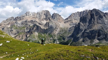
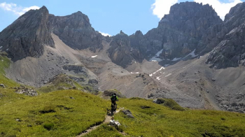
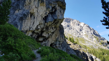
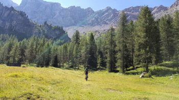
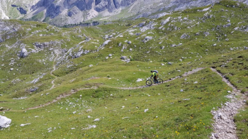
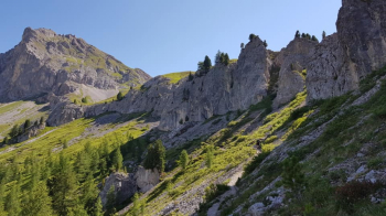
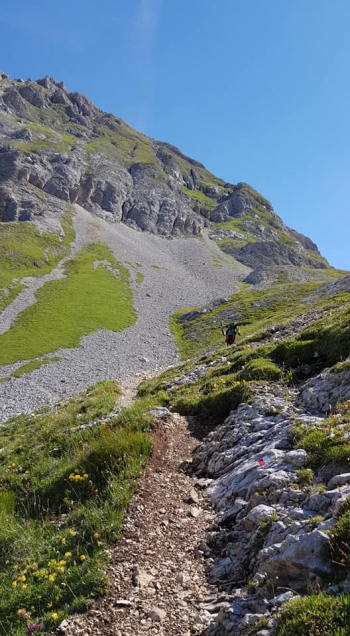
We start in Val san Nicolò near the Crocifisso malga, first on asphalt with challenging ramps then on a dirt road until we reach the Forcia malga with its beautiful waterfall. You follow path 609 that immediately climbs with a very strong slope that cannot be overcome all in the saddle. When you reach some malghe you climb up in the saddle on a grassy path and undergrowth trail for a short stretch, after which you start a long and hard section with bike on your back passing under some beautiful rock walls, with a panorama of the whole valley up to Pozza di Fassa. Reaching the saddle below Col Ombert with its magnificent lace, a pedaled and then pushed segment follows to Paschè at 2499 meters.

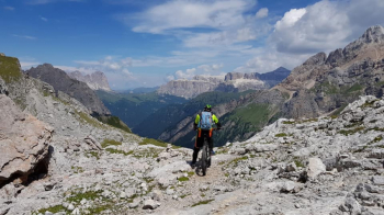
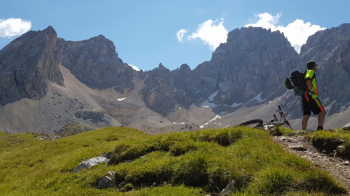
A show-stopping panorama, in front of us the stunning Marmolada and in the distance nothing but beautiful peaks. The descent is impassable for the first 10 meters, then follows a technical trail over fixed, boulder-strewn rocks that test your balance. The trail disappears at times but we are so attracted by the beautiful technical passages that we navigate by sight for a while. Once past the first technical part the trail becomes easier, in places still with beautiful technical passages, a few short climbs and a final, never fast descent on a trail with fixed, dull rocks and a few nice switchbacks to the Contrin hut.

The descent from the refuge up the entire Contrin valley is on dirt road but with a good eye there are several really fun trail cuts before reaching Alba di Canazei, where some fairly challenging trail cuts take us out of the valley. A beautiful bike path that runs along the stream takes us from Canazei to Pozza di Fassa, a short climb takes us back to our starting point.

Download our free mobile app to send this route to your Garmin device or to navigate it on OSM maps. Android - iOS
Local weather
Today
16 °C
Tonight
9 °C
Tomorrow
13 °C
Tomorrow night
6 °C
Tuesday
15 °C
Tuesday night
6 °C
Wednesday
13 °C
Wednesday night
7 °C
Thursday
8 °C
Thursday night
0 °C

Graph

Nearest Routes

2023/02/26
- Italy - Trentino-Alto Adige/Südtirol, TN
nonnocarb
(284)
24,50 km
Km
+1 500 mt
Vertical meters
Route difficulty
Landscapes
2023/07/28
- Italy - Trentino-Alto Adige/Südtirol, TN
pozzoligio
(93)
35,59 km
Km
+1 551 mt
Vertical meters
Route difficulty
Landscapes
2023/07/27
- Italy - Trentino-Alto Adige/Südtirol, TN
pozzoligio
(93)
47,84 km
Km
+2 292 mt
Vertical meters
Route difficulty
Landscapes
2023/07/25
- Italy - Trentino-Alto Adige/Südtirol, TN
pozzoligio
(93)
55,87 km
Km
+1 637 mt
Vertical meters
Route difficulty
Landscapes
2023/07/25
- Italy - Trentino-Alto Adige/Südtirol, TN
pozzoligio
(93)
64,76 km
Km
+2 100 mt
Vertical meters
Route difficulty
Landscapes
2022/10/22
- Italy - Trentino-Alto Adige/Südtirol, TN
nonnocarb
(284)
41,88 km
Km
+2 190 mt
Vertical meters
Route difficulty
Landscapes
2022/08/20
- Italy - Trentino-Alto Adige/Südtirol, TN
pozzoligio
(93)
28,10 km
Km
+791 mt
Vertical meters
Route difficulty
Landscapes
2022/08/19
- Italy - Trentino-Alto Adige/Südtirol, TN
pozzoligio
(93)
51,42 km
Km
+2 048 mt
Vertical meters
Route difficulty
Landscapes
2023/03/06
- Italy - Trentino-Alto Adige/Südtirol, TN
nonnocarb
(284)
20,80 km
Km
+1 120 mt
Vertical meters
Route difficulty
Landscapes
2024/07/30
- Italy - Trentino-Alto Adige/Südtirol, TN
Staff
(57)
32,71 km
Km
+1 088 mt
Vertical meters
Route difficulty
Landscapes

0 Comments