Italiano
 Deutsch
Monte Penello e compagnia bella
Mount Penello (995 meters) is a broad rounded peak that rises in the central part of the Scaggia summit plateau. It is a decidedly inconspicuous peak but very popular because of the vast panorama, from the Ligurian Gulf to the Po Valley and the Alps. With its spurs it dominates the Varenna Valley and the Genoese districts of Pegli and Prà.
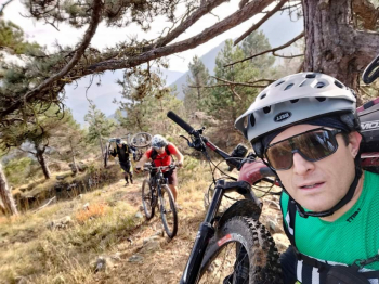
The departure for our coveted destination is from the convenient and free parking lot right in front of the Prà Container Port. After a brief obligatory stop to pick up the famous and succulent Ligurian focaccia, we head in the direction of La Penna from the isolated and little-visited Val Branega, which in a short time and strenuous pedaling on the finish, catapults us into the charming Acquasanta Locality.
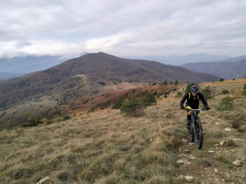
Now a long climb awaits us, always not very steep on the "Strada Comunale delle Giutte" that after about 10km brings us to the area of Passo del Turchino; we do not reach it because near a bar we turn right and enter along the Alta Via dei Monti Liguri, in the direction of Colle Gandolfi. Route that initially proceeds on a wooded dirt road slightly uphill and then continues on a winding path with open spaces and remarkable views of the coast and inland. We pass through the Passo del Veleno after which we have some push-bike stretches immersed in the typical vegetation of the Ligurian hinterland, very beautiful. In short we arrive at the first destination of the day: the Gandolfi Pass!
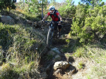
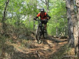
But it is not yet time to climb to the Pennello, which is right next door. We enjoy as tradition our focaccia with onions, put on our protective gear and are ready to tackle the first descent of today: the Gandalf Trail. Enthusiastic classic Ligurian trail with boulders rocks and technical passages not easy and on the final nice hairpin bends to be done all in the saddle (the good ones). We are in Camposilvano already nicely brazed.
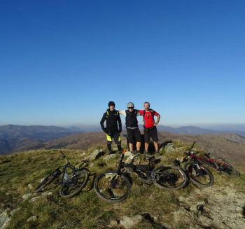
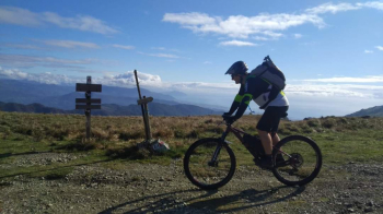
Little rest and we begin to climb laboriously up to the Rocca Maia area, which we reach with a push finish. We finally proceed toward the Pennello on a tiring little road until we intersect the dirt road coming from Colla di Praglia. Now in no time we reach Colle Gandolfi, and with a final pedal climb we are on Mount Pennello.
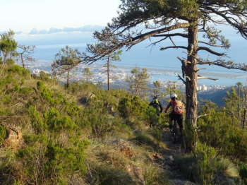
But it is not over. We must return to our cars. Our perplexities about the descent we are about to face soon turn into pure adrenaline; we are on the infamous E1. Classic Ligurian sgarrupo spaccagengive. Challenging, hard, at times (a few) flowing and scenic trail that overlooking Genoa catapults us into Villa Doria Centurione Park. By now it is dark, city traffic lights and in no time we are at the cars. Tired, happy and above all alive! Tour recommended for lovers of the "Ligurian sgarrupo" genre and well-trained and motivated bikers.