HOME RANKINGS CHALLENGES ROUTES NEAR ME PLANNING SEARCH LOGIN
Italy - Valle d'Aosta, AO
2023/09/29 20:49:06

Rifugio Teodulo

7 Downloads
0
 
Share
Author
pozzoligio
(93)
Place
Italy - Valle d'Aosta, AO
Km
47,97 km
Elapsed time
06:36:57
Vertical meters
+2 400 mt (1551 - 3298)
Route difficulty
Landscapes
Last update
2023/09/30 09:17:11
Comments
0
Description

This is a fantastic tour, very hard but with incredible views, done by ebike. From the parking lot of the Valtournanche lifts you go up a nice dirt road in the woods, pass some small tunnels and you start to see the Matterhorn
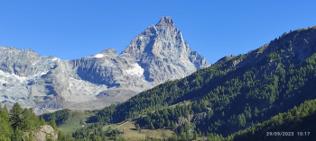
Continue to Cervinia with trail and asphalt then start the steep, nice dirt road to Plan Maison. Continue up the ski slope dirt roads, climb well until Fornet then the climb becomes steeper and fatigue and altitude begin to set in. Nice view of the Cervinia valley.
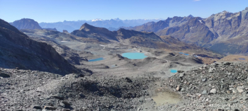
Last part of the climb from Bontadini really hard, but at the top wonderful views of the Plateu Rosa glacier.
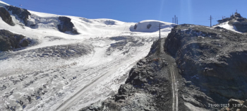
I think this is the highest altitude reachable by pedaling. For the return descend and then turn left on dirt road to the Cime Bianche cable car, pass by some small lakes.
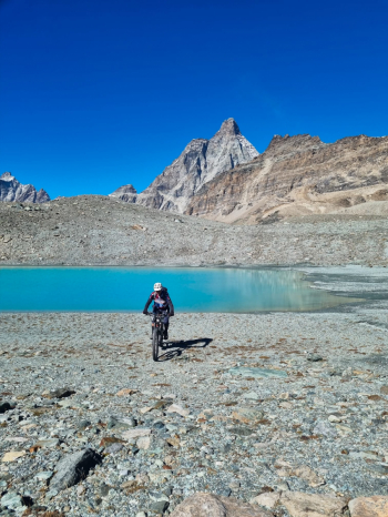
Now last climb to the arrival of the chairlift where there are views of the Cervinia valley, Plateu Rosa and Champoluc valley.
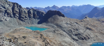
Now very long descent on dirt road to the start with always beautiful views.

Download our free mobile app to send this route to your Garmin device or to navigate it on OSM maps. Android - iOS
Local weather
°C
°C
°C
°C
°C
°C
°C
°C
°C
°C

Graph

Nearest Routes

2022/09/02
- Italy - Valle d'Aosta, AO
paiogs
(12)
28,05 km
Km
+2 000 mt
Vertical meters
Route difficulty
Landscapes
2022/08/22
- Italy - Valle d'Aosta, AO
nonnocarb
(292)
19,23 km
Km
+899 mt
Vertical meters
Route difficulty
Landscapes
2023/09/29
- Italy - Valle d'Aosta, AO
gmzolenart
(115)
14,52 km
Km
+864 mt
Vertical meters
Route difficulty
Landscapes
2023/02/05
- Italy - Valle d'Aosta, AO
BAROLO71
(34)
27,80 km
Km
+2 099 mt
Vertical meters
Route difficulty
Landscapes
2022/09/02
- Italy - Valle d'Aosta, AO
paiogs
(12)
47,61 km
Km
+2 400 mt
Vertical meters
Route difficulty
Landscapes
32,97 km
Km
+1 521 mt
Vertical meters
Route difficulty
Landscapes
2023/11/27
- Italy - Valle d'Aosta, AO
33,54 km
Km
+1 450 mt
Vertical meters
Route difficulty
Landscapes
2023/03/10
- Italy - Valle d'Aosta, AO
gmzolenart
(115)
28,72 km
Km
+1 121 mt
Vertical meters
Route difficulty
Landscapes
2022/12/22
- Italy - Valle d'Aosta, AO
gmzolenart
(115)
19,73 km
Km
+1 385 mt
Vertical meters
Route difficulty
Landscapes
32,17 km
Km
+1 969 mt
Vertical meters
Route difficulty
Landscapes

0 Comments