HOME RANKINGS CHALLENGES ROUTES POI PLANNING SEARCH LOGIN
Italy - Valle d'Aosta, AO
2023/09/29 20:29:24

Cervinia - Orionde

1 Downloads
0
 
Author
gmzolenart
(104)
Place
Italy - Valle d'Aosta, AO
Km
14,52 km
Elapsed time
04:01:41
Vertical meters
+864 mt (1887 - 2685)
Route difficulty
Landscapes
Last update
2023/09/30 09:15:29
Comments
0
Description

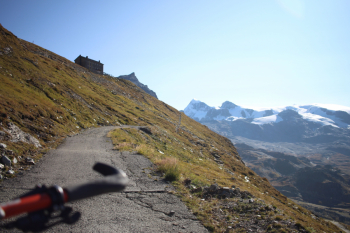
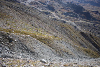
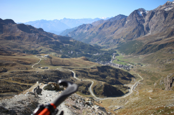
Departure from Cervinia. Signage indicates trail marker No. 13 with 2 hours and 25 on foot to ascend to Rifugio Oriondè Duca Degli Abruzzi, in 2 hours on sometimes dirt and sometimes paved terrain to gain 800 meters of elevation gain in about 7 km to arrive at an altitude of 2,835 meters. Majestic views of Rollin's Hump, Little Matterhorn and Western Breithorn. Lower down Goillet Lake and Plan Maison.

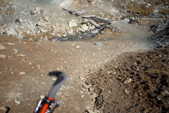
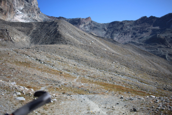
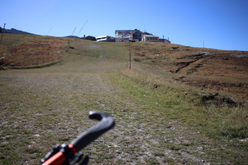
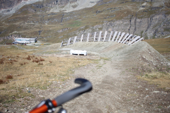
Descent: signpost #65 indicates 55-minute walk to Plan Maison; EE difficulty is exaggerated. The first part of the descent is on narrow trail that slopes gently and continues with a traverse to the steep ridge; steep and slippery and not exposed. Arriving on the flat turns out a section in the meadow to be intuited to get to Plan Maison and the entrance to the dh trail. The terrain is in excellent condition, the wooden parabolics less so, also the little bridge is under restoration and the ford to be engineered, it seemed better to me to dig upstream of the bridge. We finally continue by trail back to Cervinia. In conclusion 5-star ride for the views, while for the variety of cycling terrain we are at much less, no dirt, no natural obstacles, not even stones.

Oriondè Refuge, Western Breithorn and Rollin's Hump.

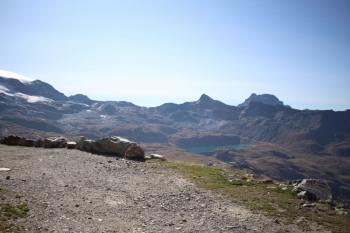
Lake Goillet and Plan Maison

Descent section with the traverse

Side view on the EE ridge, but it is not exposed

On the ridge

Plan Maison

Initial section dh slope.

Woad


Download our free mobile app to send this route to your Garmin device or to navigate it on OSM maps. Android - iOS

Graph

Nearest Routes

2022/08/22
- Italy - Valle d'Aosta, AO
nonnocarb
(268)
19,23 km
Km
+899 mt
Vertical meters
Route difficulty
Landscapes
2023/09/29
- Italy - Valle d'Aosta, AO
pozzoligio
(87)
47,97 km
Km
+2 400 mt
Vertical meters
Route difficulty
Landscapes
2022/09/02
- Italy - Valle d'Aosta, AO
paiogs
(12)
28,05 km
Km
+2 000 mt
Vertical meters
Route difficulty
Landscapes
2023/02/05
- Italy - Valle d'Aosta, AO
BAROLO71
(33)
27,80 km
Km
+2 099 mt
Vertical meters
Route difficulty
Landscapes
27,22 km
Km
+1 332 mt
Vertical meters
Route difficulty
Landscapes
2022/09/02
- Italy - Valle d'Aosta, AO
paiogs
(12)
47,61 km
Km
+2 400 mt
Vertical meters
Route difficulty
Landscapes
32,97 km
Km
+1 521 mt
Vertical meters
Route difficulty
Landscapes
2023/11/27
- Italy - Valle d'Aosta, AO
33,54 km
Km
+1 450 mt
Vertical meters
Route difficulty
Landscapes
2023/03/10
- Italy - Valle d'Aosta, AO
gmzolenart
(104)
28,72 km
Km
+1 121 mt
Vertical meters
Route difficulty
Landscapes
2022/12/22
- Italy - Valle d'Aosta, AO
gmzolenart
(104)
19,73 km
Km
+1 385 mt
Vertical meters
Route difficulty
Landscapes

0 Comments